You are here: Home > Network List > CI - Caltech Regional Seismic Network Stations List
> Station MPP McPhearson Peak > Earthquake Result Viewer
MPP McPhearson Peak - Earthquake Result Viewer
*The percent match for this event was below the threshold and hence no stack was calculated.
| Earthquake location: |
Tonga Islands |
| Earthquake latitude/longitude: |
-15.8/-173.5 |
| Earthquake time(UTC): |
2009/05/13 (133) 21:31:17 GMT |
| Earthquake Depth: |
85 km |
| Earthquake Magnitude: |
5.8 MW, 5.3 MB, 5.8 MW |
| Earthquake Catalog/Contributor: |
WHDF/NEIC |
|
| Network: |
CI Caltech Regional Seismic Network |
| Station: |
MPP McPhearson Peak |
| Lat/Lon: |
34.89 N/119.81 W |
| Elevation: |
1739 m |
|
| Distance: |
71.6 deg |
| Az: |
44.261 deg |
| Baz: |
234.837 deg |
| Ray Param: |
$rayparam |
*The percent match for this event was below the threshold and hence was not used in the summary stack. |
|
| Radial Match: |
57.268692 % |
| Radial Bump: |
400 |
| Transverse Match: |
50.431625 % |
| Transverse Bump: |
400 |
| SOD ConfigId: |
2760 |
| Insert Time: |
2010-02-26 02:04:55.285 +0000 |
| GWidth: |
2.5 |
| Max Bumps: |
400 |
| Tol: |
0.001 |
|
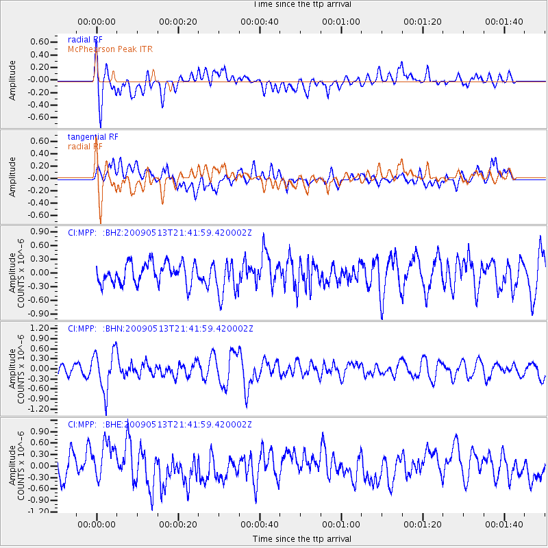
Signal To Noise
| Channel | StoN | STA | LTA |
| CI:MPP: :BHN:20090513T21:41:59.420002Z | 3.0666964 | 6.128609E-7 | 1.99844E-7 |
| CI:MPP: :BHE:20090513T21:41:59.420002Z | 1.7352442 | 5.1082776E-7 | 2.943838E-7 |
| CI:MPP: :BHZ:20090513T21:41:59.420002Z | 1.7193645 | 3.861989E-7 | 2.2461722E-7 |
| Arrivals |
| Ps | |
| PpPs | |
| PsPs/PpSs | |


