You are here: Home > Network List > CI - Caltech Regional Seismic Network Stations List
> Station MPP McPhearson Peak > Earthquake Result Viewer
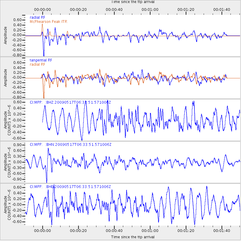
MPP McPhearson Peak - Earthquake Result Viewer
*The percent match for this event was below the threshold and hence no stack was calculated.
| Earthquake location: |
Tonga Islands |
| Earthquake latitude/longitude: |
-16.8/-173.5 |
| Earthquake time(UTC): |
2009/05/17 (137) 06:23:03 GMT |
| Earthquake Depth: |
67 km |
| Earthquake Magnitude: |
5.5 MB, 5.6 MW, 5.6 MW |
| Earthquake Catalog/Contributor: |
WHDF/NEIC |
|
| Network: |
CI Caltech Regional Seismic Network |
| Station: |
MPP McPhearson Peak |
| Lat/Lon: |
34.89 N/119.81 W |
| Elevation: |
1739 m |
|
| Distance: |
72.4 deg |
| Az: |
44.019 deg |
| Baz: |
234.055 deg |
| Ray Param: |
$rayparam |
*The percent match for this event was below the threshold and hence was not used in the summary stack. |
|
| Radial Match: |
66.3218 % |
| Radial Bump: |
400 |
| Transverse Match: |
61.267357 % |
| Transverse Bump: |
400 |
| SOD ConfigId: |
2760 |
| Insert Time: |
2010-02-26 02:04:55.856 +0000 |
| GWidth: |
2.5 |
| Max Bumps: |
400 |
| Tol: |
0.001 |
|
Signal To Noise
| Channel | StoN | STA | LTA |
| CI:MPP: :BHN:20090517T06:33:51.571006Z | 2.2295494 | 4.4243163E-7 | 1.9843992E-7 |
| CI:MPP: :BHE:20090517T06:33:51.571006Z | 1.3368659 | 2.6205E-7 | 1.9601818E-7 |
| CI:MPP: :BHZ:20090517T06:33:51.571006Z | 0.8081051 | 2.5297982E-7 | 3.130531E-7 |
| Arrivals |
| Ps | |
| PpPs | |
| PsPs/PpSs | |


