You are here: Home > Network List > UW - Pacific Northwest Regional Seismic Network Stations List
> Station LEBA Lebam, WA, USA > Earthquake Result Viewer
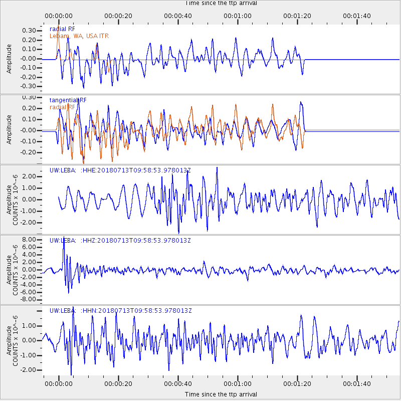
LEBA Lebam, WA, USA - Earthquake Result Viewer
*The percent match for this event was below the threshold and hence no stack was calculated.
| Earthquake location: |
Vanuatu Islands |
| Earthquake latitude/longitude: |
-18.9/169.0 |
| Earthquake time(UTC): |
2018/07/13 (194) 09:46:49 GMT |
| Earthquake Depth: |
169 km |
| Earthquake Magnitude: |
6.4 Mww |
| Earthquake Catalog/Contributor: |
NEIC PDE/us |
|
| Network: |
UW Pacific Northwest Regional Seismic Network |
| Station: |
LEBA Lebam, WA, USA |
| Lat/Lon: |
46.55 N/123.56 W |
| Elevation: |
73 m |
|
| Distance: |
89.0 deg |
| Az: |
39.596 deg |
| Baz: |
240.939 deg |
| Ray Param: |
$rayparam |
*The percent match for this event was below the threshold and hence was not used in the summary stack. |
|
| Radial Match: |
67.6111 % |
| Radial Bump: |
400 |
| Transverse Match: |
74.92343 % |
| Transverse Bump: |
400 |
| SOD ConfigId: |
13570011 |
| Insert Time: |
2019-04-30 13:47:20.796 +0000 |
| GWidth: |
2.5 |
| Max Bumps: |
400 |
| Tol: |
0.001 |
|
Signal To Noise
| Channel | StoN | STA | LTA |
| UW:LEBA: :HHZ:20180713T09:58:53.978013Z | 9.886539 | 3.2291243E-6 | 3.2661825E-7 |
| UW:LEBA: :HHN:20180713T09:58:53.978013Z | 2.054041 | 9.210152E-7 | 4.4839183E-7 |
| UW:LEBA: :HHE:20180713T09:58:53.978013Z | 1.3674183 | 8.9302677E-7 | 6.5307506E-7 |
| Arrivals |
| Ps | |
| PpPs | |
| PsPs/PpSs | |


