You are here: Home > Network List > CI - Caltech Regional Seismic Network Stations List
> Station MPP McPhearson Peak > Earthquake Result Viewer
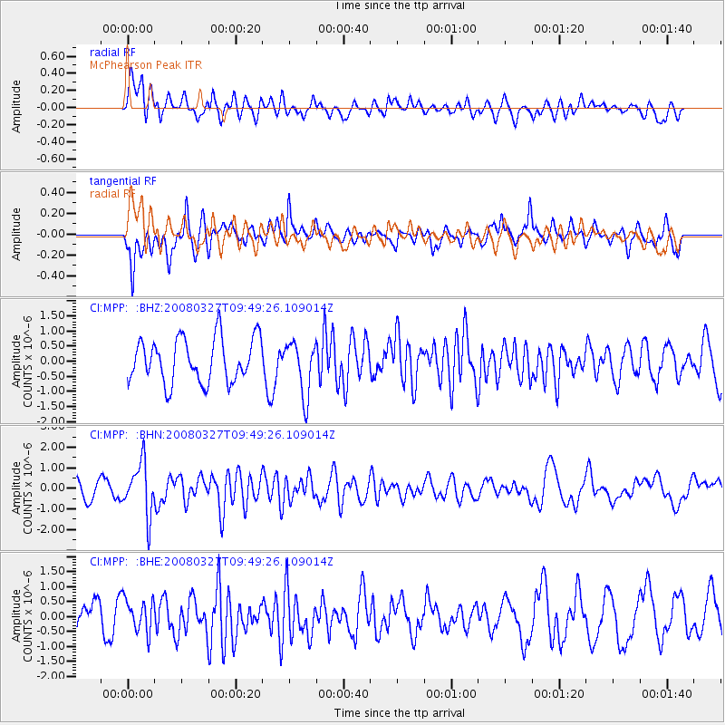
MPP McPhearson Peak - Earthquake Result Viewer
*The percent match for this event was below the threshold and hence no stack was calculated.
| Earthquake location: |
North Of Honduras |
| Earthquake latitude/longitude: |
17.2/-84.8 |
| Earthquake time(UTC): |
2008/03/27 (087) 09:42:57 GMT |
| Earthquake Depth: |
10 km |
| Earthquake Magnitude: |
5.6 MW, 5.1 MS, 5.4 MB, 5.6 MW |
| Earthquake Catalog/Contributor: |
WHDF/NEIC |
|
| Network: |
CI Caltech Regional Seismic Network |
| Station: |
MPP McPhearson Peak |
| Lat/Lon: |
34.89 N/119.81 W |
| Elevation: |
1739 m |
|
| Distance: |
35.8 deg |
| Az: |
306.31 deg |
| Baz: |
110.452 deg |
| Ray Param: |
$rayparam |
*The percent match for this event was below the threshold and hence was not used in the summary stack. |
|
| Radial Match: |
67.92433 % |
| Radial Bump: |
400 |
| Transverse Match: |
72.50454 % |
| Transverse Bump: |
400 |
| SOD ConfigId: |
2504 |
| Insert Time: |
2010-02-26 02:04:58.469 +0000 |
| GWidth: |
2.5 |
| Max Bumps: |
400 |
| Tol: |
0.001 |
|
Signal To Noise
| Channel | StoN | STA | LTA |
| CI:MPP: :BHN:20080327T09:49:26.109014Z | 2.9436364 | 1.2703808E-6 | 4.315685E-7 |
| CI:MPP: :BHE:20080327T09:49:26.109014Z | 0.77210283 | 5.509706E-7 | 7.1359744E-7 |
| CI:MPP: :BHZ:20080327T09:49:26.109014Z | 1.2186402 | 8.867555E-7 | 7.276598E-7 |
| Arrivals |
| Ps | |
| PpPs | |
| PsPs/PpSs | |


