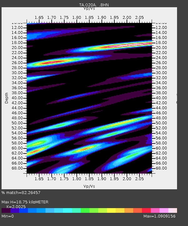
O20A White River City, CO, USA - Earthquake Result Viewer

Earthquake location: Rat Islands, Aleutian Islands
Earthquake latitude/longitude: 50.4/177.0
Earthquake time(UTC): 2009/07/06 (187) 14:53:12 GMT
Earthquake Depth: 22 km
Earthquake Magnitude: 6.0 MB, 5.8 MS, 6.1 MW, 6.0 MW
Earthquake Catalog/Contributor: WHDF/NEIC
Network: TA USArray Transportable Network (new EarthScope stations)
Station: O20A White River City, CO, USA
Lat/Lon: 40.13 N/108.24 W
Elevation: 1915 m
Distance: 51.5 deg
Az: 70.93 deg
Baz: 307.968 deg
Ray Param: 0.06733996
Estimated Moho Depth: 18.75 km
Estimated Crust Vp/Vs: 2.00
Assumed Crust Vp: 6.207 km/s
Estimated Crust Vs: 3.1 km/s
Estimated Crust Poisson's Ratio: 0.33
Radial Match: 82.26457 %
Radial Bump: 400
Transverse Match: 81.11191 %
Transverse Bump: 400
SOD ConfigId: 2622
Insert Time: 2010-03-06 12:41:30.449 +0000
GWidth: 2.5
Max Bumps: 400
Tol: 0.001

Signal To Noise

ChannelStoNSTALTA
TA:O20A: :BHN:20090706T15:01:45.25001Z14.7468622.0783207E-61.4093307E-7
TA:O20A: :BHE:20090706T15:01:45.25001Z2.72197655.2025666E-71.9113193E-7
TA:O20A: :BHZ:20090706T15:01:45.25001Z4.11382348.175621E-71.9873535E-7
Arrivals
Ps3.2 SECOND
PpPs8.7 SECOND
PsPs/PpSs12 SECOND