You are here: Home > Network List > CI - Caltech Regional Seismic Network Stations List
> Station MPP McPhearson Peak > Earthquake Result Viewer
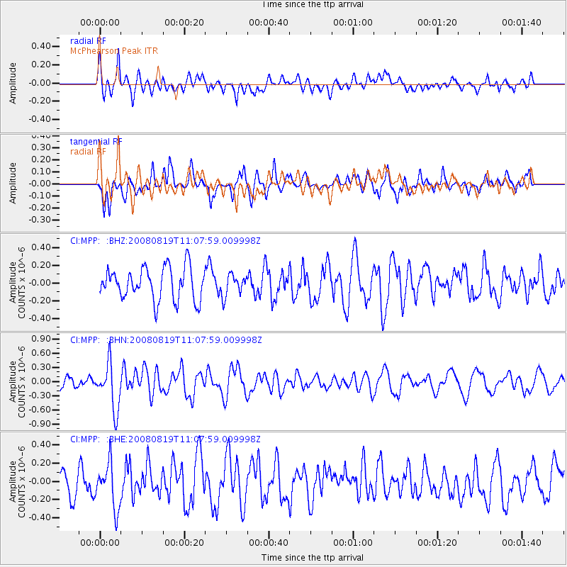
MPP McPhearson Peak - Earthquake Result Viewer
*The percent match for this event was below the threshold and hence no stack was calculated.
| Earthquake location: |
Easter Island Region |
| Earthquake latitude/longitude: |
-28.5/-112.8 |
| Earthquake time(UTC): |
2008/08/19 (232) 10:58:00 GMT |
| Earthquake Depth: |
9.0 km |
| Earthquake Magnitude: |
5.5 MB, 5.3 MS, 5.7 MW, 5.7 MW |
| Earthquake Catalog/Contributor: |
WHDF/NEIC |
|
| Network: |
CI Caltech Regional Seismic Network |
| Station: |
MPP McPhearson Peak |
| Lat/Lon: |
34.89 N/119.81 W |
| Elevation: |
1739 m |
|
| Distance: |
63.4 deg |
| Az: |
353.595 deg |
| Baz: |
173.143 deg |
| Ray Param: |
$rayparam |
*The percent match for this event was below the threshold and hence was not used in the summary stack. |
|
| Radial Match: |
48.67385 % |
| Radial Bump: |
400 |
| Transverse Match: |
52.510094 % |
| Transverse Bump: |
385 |
| SOD ConfigId: |
2504 |
| Insert Time: |
2010-02-26 02:05:03.068 +0000 |
| GWidth: |
2.5 |
| Max Bumps: |
400 |
| Tol: |
0.001 |
|
Signal To Noise
| Channel | StoN | STA | LTA |
| CI:MPP: :BHN:20080819T11:07:59.009998Z | 4.682745 | 5.0113573E-7 | 1.0701752E-7 |
| CI:MPP: :BHE:20080819T11:07:59.009998Z | 1.8376018 | 2.7033474E-7 | 1.4711281E-7 |
| CI:MPP: :BHZ:20080819T11:07:59.009998Z | 0.6738993 | 1.2270897E-7 | 1.8208799E-7 |
| Arrivals |
| Ps | |
| PpPs | |
| PsPs/PpSs | |


