You are here: Home > Network List > PF - Volcanologic Network of Piton de Fournaise-OVPF Stations List
> Station HIM cratere Himiltrude > Earthquake Result Viewer
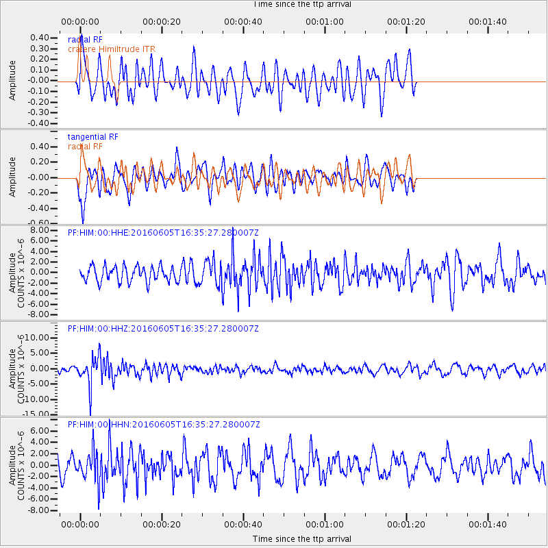
HIM cratere Himiltrude - Earthquake Result Viewer
*The percent match for this event was below the threshold and hence no stack was calculated.
| Earthquake location: |
Banda Sea |
| Earthquake latitude/longitude: |
-4.6/125.6 |
| Earthquake time(UTC): |
2016/06/05 (157) 16:25:33 GMT |
| Earthquake Depth: |
429 km |
| Earthquake Magnitude: |
6.3 MWB |
| Earthquake Catalog/Contributor: |
NEIC PDE/NEIC COMCAT |
|
| Network: |
PF Volcanologic Network of Piton de Fournaise-OVPF |
| Station: |
HIM cratere Himiltrude |
| Lat/Lon: |
21.21 S/55.72 E |
| Elevation: |
1958 m |
|
| Distance: |
69.6 deg |
| Az: |
249.186 deg |
| Baz: |
86.996 deg |
| Ray Param: |
$rayparam |
*The percent match for this event was below the threshold and hence was not used in the summary stack. |
|
| Radial Match: |
53.760445 % |
| Radial Bump: |
400 |
| Transverse Match: |
66.15944 % |
| Transverse Bump: |
400 |
| SOD ConfigId: |
1609551 |
| Insert Time: |
2016-06-22 15:02:32.490 +0000 |
| GWidth: |
2.5 |
| Max Bumps: |
400 |
| Tol: |
0.001 |
|
Signal To Noise
| Channel | StoN | STA | LTA |
| PF:HIM:00:HHZ:20160605T16:35:27.280007Z | 4.322948 | 4.5625425E-6 | 1.0554239E-6 |
| PF:HIM:00:HHN:20160605T16:35:27.280007Z | 1.891151 | 2.6951536E-6 | 1.4251394E-6 |
| PF:HIM:00:HHE:20160605T16:35:27.280007Z | 1.5660176 | 2.2143056E-6 | 1.4139723E-6 |
| Arrivals |
| Ps | |
| PpPs | |
| PsPs/PpSs | |


