You are here: Home > Network List > CI - Caltech Regional Seismic Network Stations List
> Station MPP McPhearson Peak > Earthquake Result Viewer
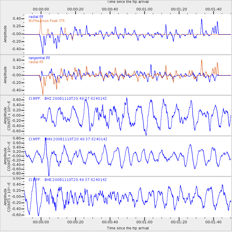
MPP McPhearson Peak - Earthquake Result Viewer
*The percent match for this event was below the threshold and hence no stack was calculated.
| Earthquake location: |
South Of Fiji Islands |
| Earthquake latitude/longitude: |
-22.2/-179.7 |
| Earthquake time(UTC): |
2008/11/19 (324) 20:38:58 GMT |
| Earthquake Depth: |
596 km |
| Earthquake Magnitude: |
5.8 MW, 5.2 MB, 5.8 MW |
| Earthquake Catalog/Contributor: |
WHDF/NEIC |
|
| Network: |
CI Caltech Regional Seismic Network |
| Station: |
MPP McPhearson Peak |
| Lat/Lon: |
34.89 N/119.81 W |
| Elevation: |
1739 m |
|
| Distance: |
80.3 deg |
| Az: |
46.183 deg |
| Baz: |
234.452 deg |
| Ray Param: |
$rayparam |
*The percent match for this event was below the threshold and hence was not used in the summary stack. |
|
| Radial Match: |
77.82077 % |
| Radial Bump: |
400 |
| Transverse Match: |
54.281628 % |
| Transverse Bump: |
400 |
| SOD ConfigId: |
2658 |
| Insert Time: |
2010-02-26 02:05:12.249 +0000 |
| GWidth: |
2.5 |
| Max Bumps: |
400 |
| Tol: |
0.001 |
|
Signal To Noise
| Channel | StoN | STA | LTA |
| CI:MPP: :BHN:20081119T20:49:37.624014Z | 2.7707136 | 4.1221455E-7 | 1.487756E-7 |
| CI:MPP: :BHE:20081119T20:49:37.624014Z | 1.102193 | 2.239732E-7 | 2.0320688E-7 |
| CI:MPP: :BHZ:20081119T20:49:37.624014Z | 1.1411906 | 2.3826202E-7 | 2.0878372E-7 |
| Arrivals |
| Ps | |
| PpPs | |
| PsPs/PpSs | |


