You are here: Home > Network List > TA - USArray Transportable Network (new EarthScope stations) Stations List
> Station 526A Mary Lane Ranch, Marfa, TX, USA > Earthquake Result Viewer
526A Mary Lane Ranch, Marfa, TX, USA - Earthquake Result Viewer

| Earthquake location: |
Off East Coast Of Honshu, Japan |
| Earthquake latitude/longitude: |
36.5/142.4 |
| Earthquake time(UTC): |
2008/12/20 (355) 10:29:23 GMT |
| Earthquake Depth: |
19 km |
| Earthquake Magnitude: |
6.0 MB, 6.3 MS, 6.3 MW, 6.3 MW |
| Earthquake Catalog/Contributor: |
WHDF/NEIC |
|
| Network: |
TA USArray Transportable Network (new EarthScope stations) |
| Station: |
526A Mary Lane Ranch, Marfa, TX, USA |
| Lat/Lon: |
30.06 N/104.09 W |
| Elevation: |
1405 m |
|
| Distance: |
89.0 deg |
| Az: |
52.679 deg |
| Baz: |
312.376 deg |
| Ray Param: |
0.04214498 |
| Estimated Moho Depth: |
32.0 km |
| Estimated Crust Vp/Vs: |
1.89 |
| Assumed Crust Vp: |
6.361 km/s |
| Estimated Crust Vs: |
3.37 km/s |
| Estimated Crust Poisson's Ratio: |
0.30 |
|
| Radial Match: |
81.956276 % |
| Radial Bump: |
400 |
| Transverse Match: |
68.56962 % |
| Transverse Bump: |
368 |
| SOD ConfigId: |
2658 |
| Insert Time: |
2010-03-06 12:45:55.956 +0000 |
| GWidth: |
2.5 |
| Max Bumps: |
400 |
| Tol: |
0.001 |
|
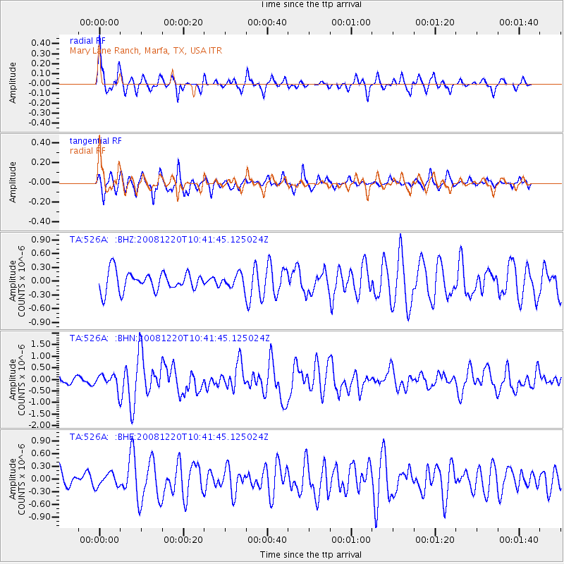
Signal To Noise
| Channel | StoN | STA | LTA |
| TA:526A: :BHN:20081220T10:41:45.125024Z | 2.4998748 | 3.278498E-7 | 1.3114649E-7 |
| TA:526A: :BHE:20081220T10:41:45.125024Z | 0.7758767 | 1.5172793E-7 | 1.9555677E-7 |
| TA:526A: :BHZ:20081220T10:41:45.125024Z | 0.7048481 | 1.4640533E-7 | 2.0771188E-7 |
| Arrivals |
| Ps | 4.6 SECOND |
| PpPs | 14 SECOND |
| PsPs/PpSs | 19 SECOND |


