You are here: Home > Network List > TA - USArray Transportable Network (new EarthScope stations) Stations List
> Station M53A WI Miller and Sons, Farmdale, OH, USA > Earthquake Result Viewer
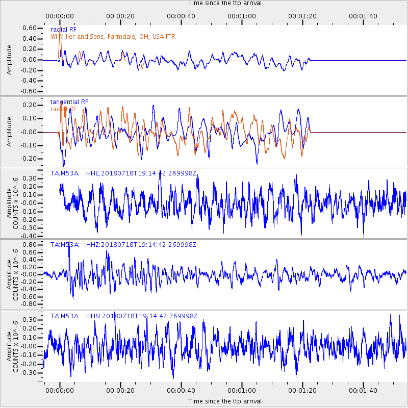
M53A WI Miller and Sons, Farmdale, OH, USA - Earthquake Result Viewer
*The percent match for this event was below the threshold and hence no stack was calculated.
| Earthquake location: |
Alaska Peninsula |
| Earthquake latitude/longitude: |
54.4/-160.7 |
| Earthquake time(UTC): |
2018/07/18 (199) 19:06:03 GMT |
| Earthquake Depth: |
28 km |
| Earthquake Magnitude: |
5.6 Mww |
| Earthquake Catalog/Contributor: |
NEIC PDE/us |
|
| Network: |
TA USArray Transportable Network (new EarthScope stations) |
| Station: |
M53A WI Miller and Sons, Farmdale, OH, USA |
| Lat/Lon: |
41.44 N/80.68 W |
| Elevation: |
334 m |
|
| Distance: |
52.3 deg |
| Az: |
69.286 deg |
| Baz: |
313.331 deg |
| Ray Param: |
$rayparam |
*The percent match for this event was below the threshold and hence was not used in the summary stack. |
|
| Radial Match: |
58.01903 % |
| Radial Bump: |
400 |
| Transverse Match: |
62.837 % |
| Transverse Bump: |
400 |
| SOD ConfigId: |
13570011 |
| Insert Time: |
2019-04-30 14:17:09.783 +0000 |
| GWidth: |
2.5 |
| Max Bumps: |
400 |
| Tol: |
0.001 |
|
Signal To Noise
| Channel | StoN | STA | LTA |
| TA:M53A: :HHZ:20180718T19:14:42.269998Z | 1.9228987 | 2.8852688E-7 | 1.5004788E-7 |
| TA:M53A: :HHN:20180718T19:14:42.269998Z | 1.0374376 | 1.3636782E-7 | 1.3144677E-7 |
| TA:M53A: :HHE:20180718T19:14:42.269998Z | 1.1279285 | 1.4312363E-7 | 1.268907E-7 |
| Arrivals |
| Ps | |
| PpPs | |
| PsPs/PpSs | |


