You are here: Home > Network List > TA - USArray Transportable Network (new EarthScope stations) Stations List
> Station 526A Mary Lane Ranch, Marfa, TX, USA > Earthquake Result Viewer
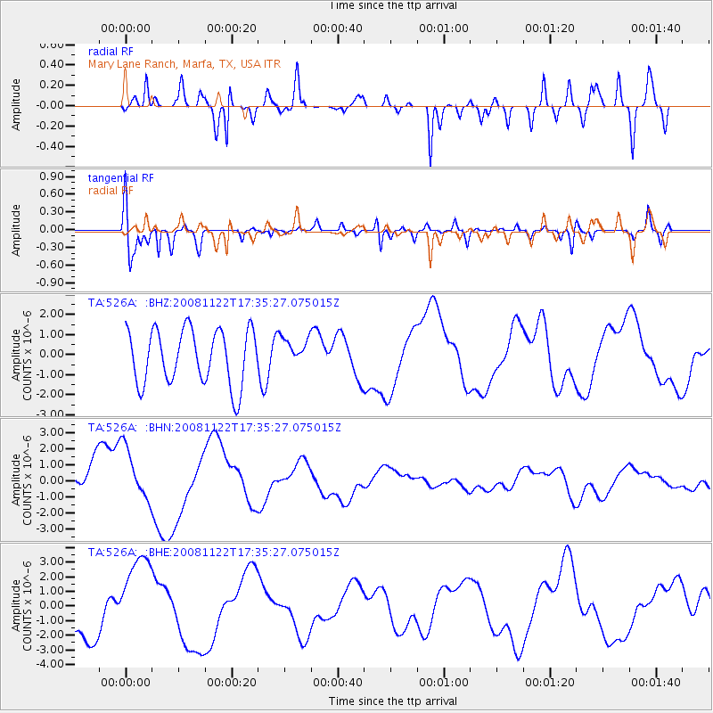
526A Mary Lane Ranch, Marfa, TX, USA - Earthquake Result Viewer
*The percent match for this event was below the threshold and hence no stack was calculated.
| Earthquake location: |
Southeast Of Loyalty Islands |
| Earthquake latitude/longitude: |
-22.4/171.2 |
| Earthquake time(UTC): |
2008/11/22 (327) 17:22:36 GMT |
| Earthquake Depth: |
69 km |
| Earthquake Magnitude: |
5.5 MB |
| Earthquake Catalog/Contributor: |
WHDF/NEIC |
|
| Network: |
TA USArray Transportable Network (new EarthScope stations) |
| Station: |
526A Mary Lane Ranch, Marfa, TX, USA |
| Lat/Lon: |
30.06 N/104.09 W |
| Elevation: |
1405 m |
|
| Distance: |
96.6 deg |
| Az: |
60.335 deg |
| Baz: |
248.017 deg |
| Ray Param: |
$rayparam |
*The percent match for this event was below the threshold and hence was not used in the summary stack. |
|
| Radial Match: |
86.238304 % |
| Radial Bump: |
400 |
| Transverse Match: |
89.94237 % |
| Transverse Bump: |
400 |
| SOD ConfigId: |
2658 |
| Insert Time: |
2010-03-06 12:47:11.014 +0000 |
| GWidth: |
2.5 |
| Max Bumps: |
400 |
| Tol: |
0.001 |
|
Signal To Noise
| Channel | StoN | STA | LTA |
| TA:526A: :BHN:20081122T17:35:27.075015Z | 1.6082026 | 1.6754788E-6 | 1.0418331E-6 |
| TA:526A: :BHE:20081122T17:35:27.075015Z | 2.2422113 | 3.1089942E-6 | 1.386575E-6 |
| TA:526A: :BHZ:20081122T17:35:27.075015Z | 0.5185314 | 7.024574E-7 | 1.3547055E-6 |
| Arrivals |
| Ps | |
| PpPs | |
| PsPs/PpSs | |


