You are here: Home > Network List > CI - Caltech Regional Seismic Network Stations List
> Station MPP McPhearson Peak > Earthquake Result Viewer
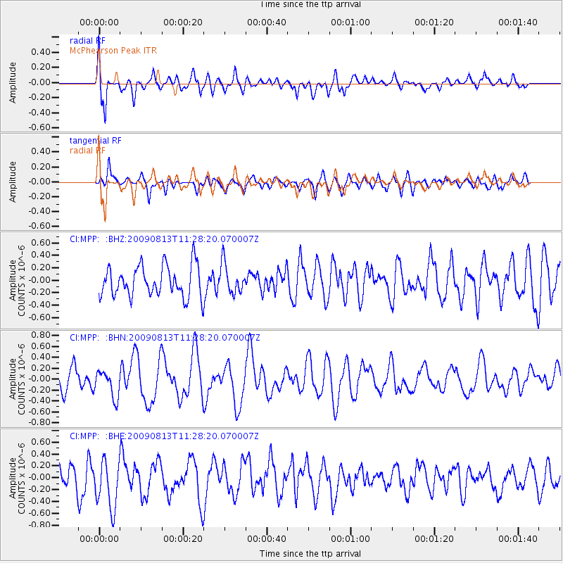
MPP McPhearson Peak - Earthquake Result Viewer
*The percent match for this event was below the threshold and hence no stack was calculated.
| Earthquake location: |
Tonga Islands |
| Earthquake latitude/longitude: |
-21.7/-174.6 |
| Earthquake time(UTC): |
2009/08/13 (225) 11:17:01 GMT |
| Earthquake Depth: |
10 km |
| Earthquake Magnitude: |
5.6 MW, 5.3 MB |
| Earthquake Catalog/Contributor: |
WHDF/NEIC |
|
| Network: |
CI Caltech Regional Seismic Network |
| Station: |
MPP McPhearson Peak |
| Lat/Lon: |
34.89 N/119.81 W |
| Elevation: |
1739 m |
|
| Distance: |
76.6 deg |
| Az: |
43.649 deg |
| Baz: |
231.357 deg |
| Ray Param: |
$rayparam |
*The percent match for this event was below the threshold and hence was not used in the summary stack. |
|
| Radial Match: |
65.00339 % |
| Radial Bump: |
400 |
| Transverse Match: |
50.718643 % |
| Transverse Bump: |
400 |
| SOD ConfigId: |
2622 |
| Insert Time: |
2010-02-26 02:05:20.799 +0000 |
| GWidth: |
2.5 |
| Max Bumps: |
400 |
| Tol: |
0.001 |
|
Signal To Noise
| Channel | StoN | STA | LTA |
| CI:MPP: :BHN:20090813T11:28:20.070007Z | 1.5407339 | 2.5046378E-7 | 1.6256134E-7 |
| CI:MPP: :BHE:20090813T11:28:20.070007Z | 2.1160877 | 4.2644393E-7 | 2.015247E-7 |
| CI:MPP: :BHZ:20090813T11:28:20.070007Z | 0.9948521 | 2.4405628E-7 | 2.4531914E-7 |
| Arrivals |
| Ps | |
| PpPs | |
| PsPs/PpSs | |


