You are here: Home > Network List > US - United States National Seismic Network Stations List
> Station MSO Missoula, Montana, USA > Earthquake Result Viewer
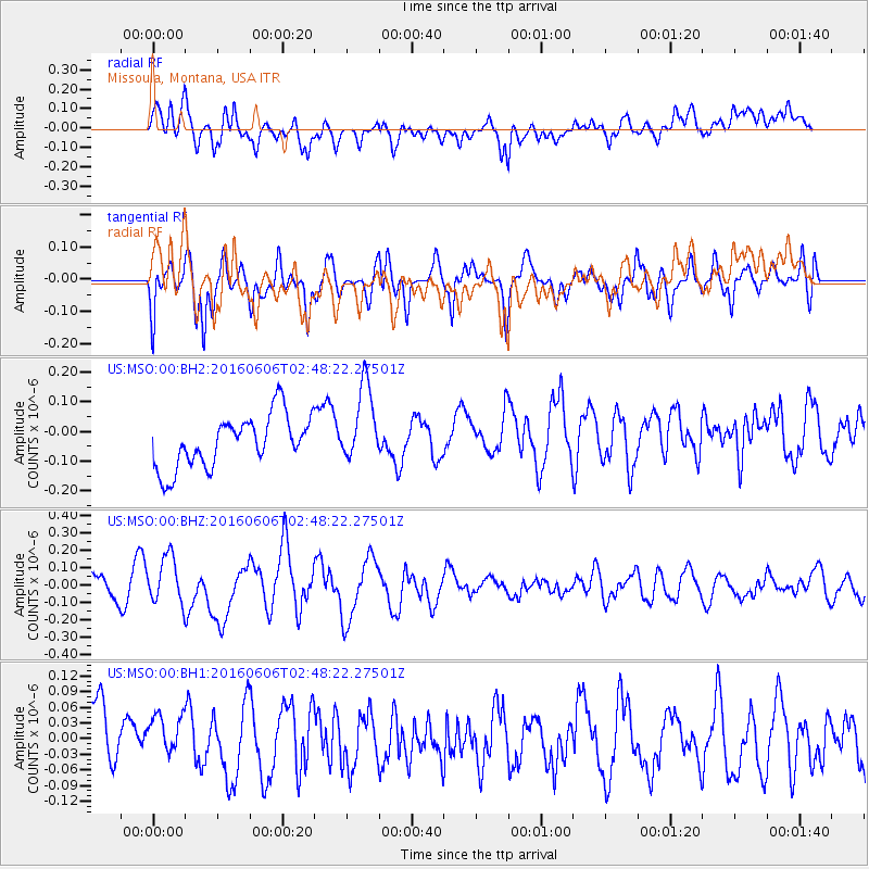
MSO Missoula, Montana, USA - Earthquake Result Viewer
*The percent match for this event was below the threshold and hence no stack was calculated.
| Earthquake location: |
Kermadec Islands, New Zealand |
| Earthquake latitude/longitude: |
-30.0/-177.8 |
| Earthquake time(UTC): |
2016/06/06 (158) 02:35:32 GMT |
| Earthquake Depth: |
44 km |
| Earthquake Magnitude: |
6.1 MWW, 6.0 MWC, 6.1 MWC |
| Earthquake Catalog/Contributor: |
NEIC PDE/NEIC COMCAT |
|
| Network: |
US United States National Seismic Network |
| Station: |
MSO Missoula, Montana, USA |
| Lat/Lon: |
46.83 N/113.94 W |
| Elevation: |
1264 m |
|
| Distance: |
95.7 deg |
| Az: |
38.293 deg |
| Baz: |
231.51 deg |
| Ray Param: |
$rayparam |
*The percent match for this event was below the threshold and hence was not used in the summary stack. |
|
| Radial Match: |
44.798344 % |
| Radial Bump: |
400 |
| Transverse Match: |
57.365444 % |
| Transverse Bump: |
400 |
| SOD ConfigId: |
1609551 |
| Insert Time: |
2016-06-22 15:07:30.143 +0000 |
| GWidth: |
2.5 |
| Max Bumps: |
400 |
| Tol: |
0.001 |
|
Signal To Noise
| Channel | StoN | STA | LTA |
| US:MSO:00:BHZ:20160606T02:48:22.27501Z | 1.7530974 | 1.3561251E-7 | 7.735595E-8 |
| US:MSO:00:BH1:20160606T02:48:22.27501Z | 0.8278597 | 5.2340855E-8 | 6.3224306E-8 |
| US:MSO:00:BH2:20160606T02:48:22.27501Z | 1.5102003 | 1.319569E-7 | 8.737709E-8 |
| Arrivals |
| Ps | |
| PpPs | |
| PsPs/PpSs | |


