You are here: Home > Network List > TA - USArray Transportable Network (new EarthScope stations) Stations List
> Station 526A Mary Lane Ranch, Marfa, TX, USA > Earthquake Result Viewer
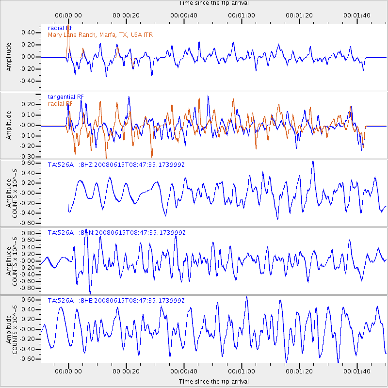
526A Mary Lane Ranch, Marfa, TX, USA - Earthquake Result Viewer
*The percent match for this event was below the threshold and hence no stack was calculated.
| Earthquake location: |
Southern East Pacific Rise |
| Earthquake latitude/longitude: |
-36.6/-107.4 |
| Earthquake time(UTC): |
2008/06/15 (167) 08:37:17 GMT |
| Earthquake Depth: |
10 km |
| Earthquake Magnitude: |
5.5 MB, 5.4 MS, 6.0 MW, 6.0 MW |
| Earthquake Catalog/Contributor: |
WHDF/NEIC |
|
| Network: |
TA USArray Transportable Network (new EarthScope stations) |
| Station: |
526A Mary Lane Ranch, Marfa, TX, USA |
| Lat/Lon: |
30.06 N/104.09 W |
| Elevation: |
1405 m |
|
| Distance: |
66.4 deg |
| Az: |
3.179 deg |
| Baz: |
182.949 deg |
| Ray Param: |
$rayparam |
*The percent match for this event was below the threshold and hence was not used in the summary stack. |
|
| Radial Match: |
65.947266 % |
| Radial Bump: |
400 |
| Transverse Match: |
53.86495 % |
| Transverse Bump: |
400 |
| SOD ConfigId: |
2504 |
| Insert Time: |
2010-03-06 12:48:34.189 +0000 |
| GWidth: |
2.5 |
| Max Bumps: |
400 |
| Tol: |
0.001 |
|
Signal To Noise
| Channel | StoN | STA | LTA |
| TA:526A: :BHN:20080615T08:47:35.173999Z | 2.9383087 | 2.9774822E-7 | 1.013332E-7 |
| TA:526A: :BHE:20080615T08:47:35.173999Z | 1.7597182 | 2.4253632E-7 | 1.3782679E-7 |
| TA:526A: :BHZ:20080615T08:47:35.173999Z | 1.3767027 | 2.3964947E-7 | 1.7407496E-7 |
| Arrivals |
| Ps | |
| PpPs | |
| PsPs/PpSs | |


