You are here: Home > Network List > TA - USArray Transportable Network (new EarthScope stations) Stations List
> Station B18K Kokolik River, AK, USA > Earthquake Result Viewer
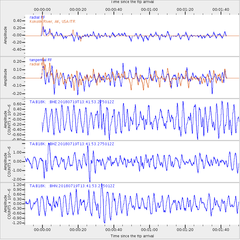
B18K Kokolik River, AK, USA - Earthquake Result Viewer
*The percent match for this event was below the threshold and hence no stack was calculated.
| Earthquake location: |
Oaxaca, Mexico |
| Earthquake latitude/longitude: |
17.8/-97.8 |
| Earthquake time(UTC): |
2018/07/19 (200) 13:31:53 GMT |
| Earthquake Depth: |
55 km |
| Earthquake Magnitude: |
5.7 Mww |
| Earthquake Catalog/Contributor: |
NEIC PDE/us |
|
| Network: |
TA USArray Transportable Network (new EarthScope stations) |
| Station: |
B18K Kokolik River, AK, USA |
| Lat/Lon: |
69.36 N/161.80 W |
| Elevation: |
222 m |
|
| Distance: |
64.4 deg |
| Az: |
339.305 deg |
| Baz: |
108.252 deg |
| Ray Param: |
$rayparam |
*The percent match for this event was below the threshold and hence was not used in the summary stack. |
|
| Radial Match: |
61.116394 % |
| Radial Bump: |
400 |
| Transverse Match: |
59.107956 % |
| Transverse Bump: |
362 |
| SOD ConfigId: |
13570011 |
| Insert Time: |
2019-04-30 14:25:57.988 +0000 |
| GWidth: |
2.5 |
| Max Bumps: |
400 |
| Tol: |
0.001 |
|
Signal To Noise
| Channel | StoN | STA | LTA |
| TA:B18K: :BHZ:20180719T13:41:53.275012Z | 2.1423159 | 1.0302724E-6 | 4.809153E-7 |
| TA:B18K: :BHN:20180719T13:41:53.275012Z | 1.0061989 | 3.585921E-7 | 3.563829E-7 |
| TA:B18K: :BHE:20180719T13:41:53.275012Z | 0.9249053 | 3.087377E-7 | 3.3380465E-7 |
| Arrivals |
| Ps | |
| PpPs | |
| PsPs/PpSs | |


