You are here: Home > Network List > TA - USArray Transportable Network (new EarthScope stations) Stations List
> Station 526A Mary Lane Ranch, Marfa, TX, USA > Earthquake Result Viewer
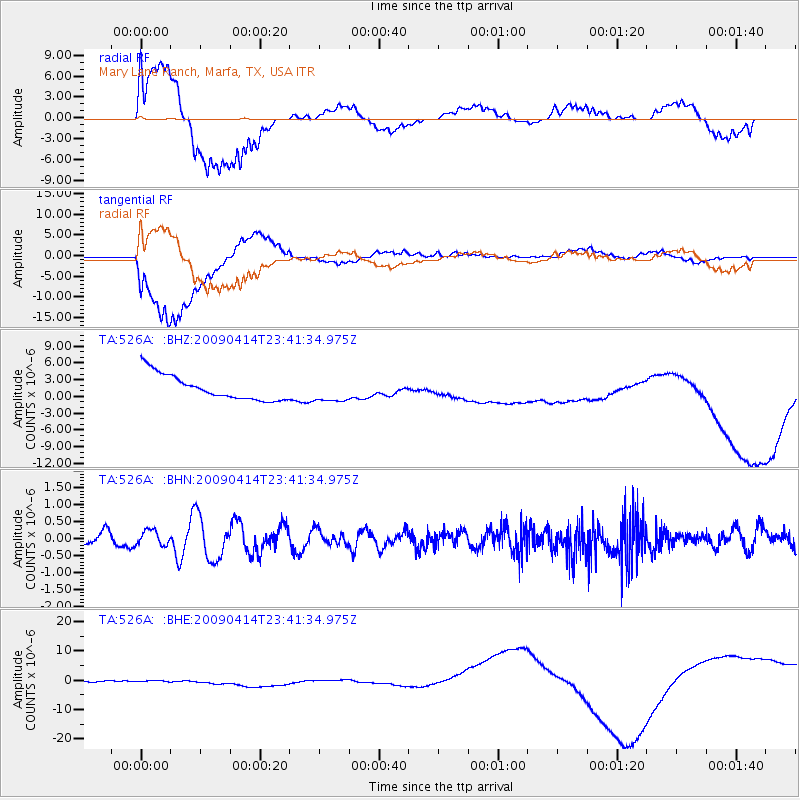
526A Mary Lane Ranch, Marfa, TX, USA - Earthquake Result Viewer
*The percent match for this event was below the threshold and hence no stack was calculated.
| Earthquake location: |
Fiji Islands Region |
| Earthquake latitude/longitude: |
-16.3/-177.7 |
| Earthquake time(UTC): |
2009/04/14 (104) 23:29:33 GMT |
| Earthquake Depth: |
10 km |
| Earthquake Magnitude: |
5.5 MS, 5.4 MB, 5.9 MW, 5.9 MW |
| Earthquake Catalog/Contributor: |
WHDF/NEIC |
|
| Network: |
TA USArray Transportable Network (new EarthScope stations) |
| Station: |
526A Mary Lane Ranch, Marfa, TX, USA |
| Lat/Lon: |
30.06 N/104.09 W |
| Elevation: |
1405 m |
|
| Distance: |
84.5 deg |
| Az: |
56.685 deg |
| Baz: |
247.762 deg |
| Ray Param: |
$rayparam |
*The percent match for this event was below the threshold and hence was not used in the summary stack. |
|
| Radial Match: |
69.49017 % |
| Radial Bump: |
400 |
| Transverse Match: |
88.71637 % |
| Transverse Bump: |
400 |
| SOD ConfigId: |
2658 |
| Insert Time: |
2010-03-06 12:48:57.267 +0000 |
| GWidth: |
2.5 |
| Max Bumps: |
400 |
| Tol: |
0.001 |
|
Signal To Noise
| Channel | StoN | STA | LTA |
| TA:526A: :BHN:20090414T23:41:34.975Z | 1.4701679 | 2.1622559E-7 | 1.4707544E-7 |
| TA:526A: :BHE:20090414T23:41:34.975Z | 0.73263264 | 6.200597E-7 | 8.463447E-7 |
| TA:526A: :BHZ:20090414T23:41:34.975Z | 0.9059665 | 2.0633156E-6 | 2.2774746E-6 |
| Arrivals |
| Ps | |
| PpPs | |
| PsPs/PpSs | |


