You are here: Home > Network List > CI - Caltech Regional Seismic Network Stations List
> Station MPP McPhearson Peak > Earthquake Result Viewer
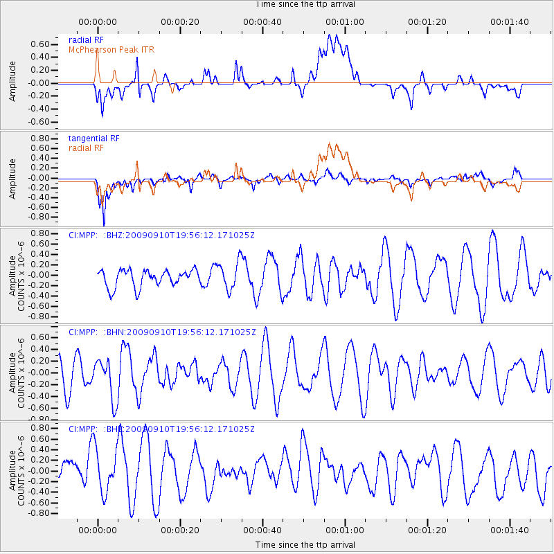
MPP McPhearson Peak - Earthquake Result Viewer
*The percent match for this event was below the threshold and hence no stack was calculated.
| Earthquake location: |
Easter Island Region |
| Earthquake latitude/longitude: |
-29.9/-111.8 |
| Earthquake time(UTC): |
2009/09/10 (253) 19:46:03 GMT |
| Earthquake Depth: |
10 km |
| Earthquake Magnitude: |
5.5 MW, 5.4 MB |
| Earthquake Catalog/Contributor: |
WHDF/NEIC |
|
| Network: |
CI Caltech Regional Seismic Network |
| Station: |
MPP McPhearson Peak |
| Lat/Lon: |
34.89 N/119.81 W |
| Elevation: |
1739 m |
|
| Distance: |
64.9 deg |
| Az: |
352.752 deg |
| Baz: |
172.343 deg |
| Ray Param: |
$rayparam |
*The percent match for this event was below the threshold and hence was not used in the summary stack. |
|
| Radial Match: |
39.20185 % |
| Radial Bump: |
400 |
| Transverse Match: |
77.54915 % |
| Transverse Bump: |
400 |
| SOD ConfigId: |
2622 |
| Insert Time: |
2010-02-26 02:05:30.790 +0000 |
| GWidth: |
2.5 |
| Max Bumps: |
400 |
| Tol: |
0.001 |
|
Signal To Noise
| Channel | StoN | STA | LTA |
| CI:MPP: :BHN:20090910T19:56:12.171025Z | 1.4228225 | 3.5838227E-7 | 2.5188123E-7 |
| CI:MPP: :BHE:20090910T19:56:12.171025Z | 1.00312 | 4.906686E-7 | 4.8914245E-7 |
| CI:MPP: :BHZ:20090910T19:56:12.171025Z | 1.6887037 | 2.7467414E-7 | 1.6265385E-7 |
| Arrivals |
| Ps | |
| PpPs | |
| PsPs/PpSs | |


