You are here: Home > Network List > CI - Caltech Regional Seismic Network Stations List
> Station MPM Manuel Prospect Mine, California, USA > Earthquake Result Viewer
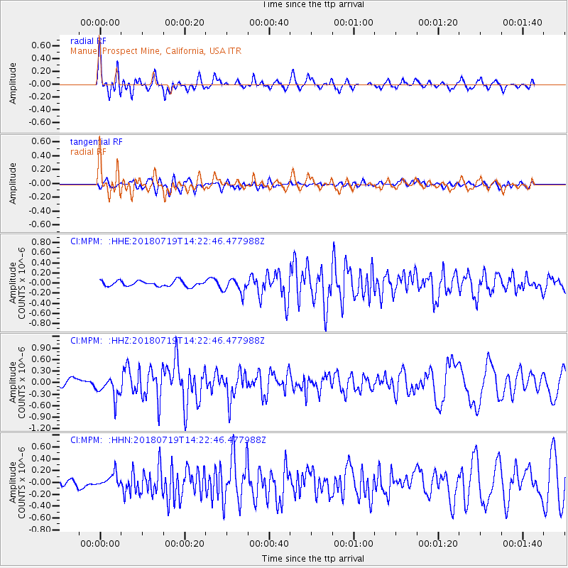
MPM Manuel Prospect Mine, California, USA - Earthquake Result Viewer
*The percent match for this event was below the threshold and hence no stack was calculated.
| Earthquake location: |
Alaska Peninsula |
| Earthquake latitude/longitude: |
54.4/-160.8 |
| Earthquake time(UTC): |
2018/07/19 (200) 14:16:27 GMT |
| Earthquake Depth: |
22 km |
| Earthquake Magnitude: |
5.8 Mww |
| Earthquake Catalog/Contributor: |
NEIC PDE/us |
|
| Network: |
CI Caltech Regional Seismic Network |
| Station: |
MPM Manuel Prospect Mine, California, USA |
| Lat/Lon: |
36.06 N/117.49 W |
| Elevation: |
185 m |
|
| Distance: |
34.9 deg |
| Az: |
103.79 deg |
| Baz: |
315.575 deg |
| Ray Param: |
$rayparam |
*The percent match for this event was below the threshold and hence was not used in the summary stack. |
|
| Radial Match: |
77.64587 % |
| Radial Bump: |
400 |
| Transverse Match: |
73.88007 % |
| Transverse Bump: |
400 |
| SOD ConfigId: |
13570011 |
| Insert Time: |
2019-04-30 14:32:20.500 +0000 |
| GWidth: |
2.5 |
| Max Bumps: |
400 |
| Tol: |
0.001 |
|
Signal To Noise
| Channel | StoN | STA | LTA |
| CI:MPM: :HHZ:20180719T14:22:46.477988Z | 2.9865026 | 2.8533276E-7 | 9.554078E-8 |
| CI:MPM: :HHN:20180719T14:22:46.477988Z | 1.5380489 | 1.1900464E-7 | 7.737377E-8 |
| CI:MPM: :HHE:20180719T14:22:46.477988Z | 2.68002 | 1.4202575E-7 | 5.299429E-8 |
| Arrivals |
| Ps | |
| PpPs | |
| PsPs/PpSs | |


