You are here: Home > Network List > CI - Caltech Regional Seismic Network Stations List
> Station MPP McPhearson Peak > Earthquake Result Viewer
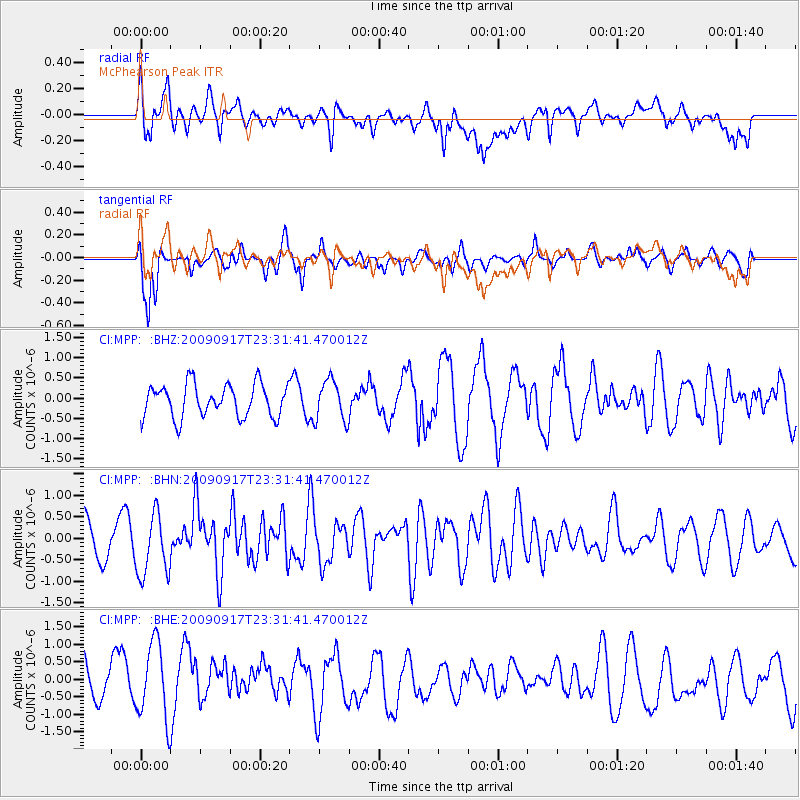
MPP McPhearson Peak - Earthquake Result Viewer
*The percent match for this event was below the threshold and hence no stack was calculated.
| Earthquake location: |
Easter Island Region |
| Earthquake latitude/longitude: |
-29.1/-112.3 |
| Earthquake time(UTC): |
2009/09/17 (260) 23:21:38 GMT |
| Earthquake Depth: |
10 km |
| Earthquake Magnitude: |
5.7 MB, 6.0 MS, 6.2 MW, 6.2 MW |
| Earthquake Catalog/Contributor: |
WHDF/NEIC |
|
| Network: |
CI Caltech Regional Seismic Network |
| Station: |
MPP McPhearson Peak |
| Lat/Lon: |
34.89 N/119.81 W |
| Elevation: |
1739 m |
|
| Distance: |
64.1 deg |
| Az: |
353.106 deg |
| Baz: |
172.662 deg |
| Ray Param: |
$rayparam |
*The percent match for this event was below the threshold and hence was not used in the summary stack. |
|
| Radial Match: |
47.36854 % |
| Radial Bump: |
400 |
| Transverse Match: |
78.95476 % |
| Transverse Bump: |
400 |
| SOD ConfigId: |
2622 |
| Insert Time: |
2010-02-26 02:05:33.899 +0000 |
| GWidth: |
2.5 |
| Max Bumps: |
400 |
| Tol: |
0.001 |
|
Signal To Noise
| Channel | StoN | STA | LTA |
| CI:MPP: :BHN:20090917T23:31:41.470012Z | 1.7679567 | 7.238499E-7 | 4.0942737E-7 |
| CI:MPP: :BHE:20090917T23:31:41.470012Z | 1.5967519 | 1.1501851E-6 | 7.20328E-7 |
| CI:MPP: :BHZ:20090917T23:31:41.470012Z | 1.2402871 | 5.0136725E-7 | 4.0423484E-7 |
| Arrivals |
| Ps | |
| PpPs | |
| PsPs/PpSs | |


