You are here: Home > Network List > TA - USArray Transportable Network (new EarthScope stations) Stations List
> Station A17A Triple J Farms, Joplin, MT, USA > Earthquake Result Viewer
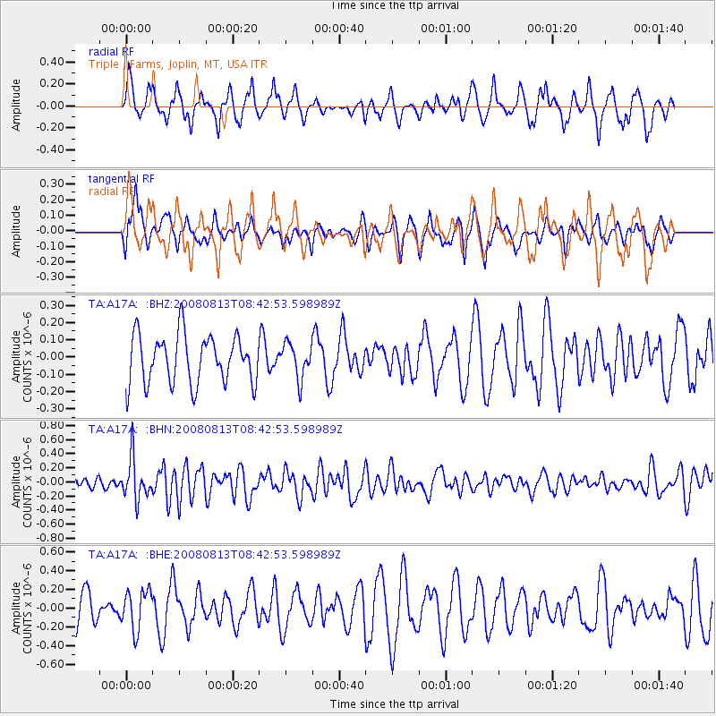
A17A Triple J Farms, Joplin, MT, USA - Earthquake Result Viewer
*The percent match for this event was below the threshold and hence no stack was calculated.
| Earthquake location: |
North Of Severnaya Zemlya |
| Earthquake latitude/longitude: |
83.6/115.2 |
| Earthquake time(UTC): |
2008/08/13 (226) 08:35:02 GMT |
| Earthquake Depth: |
10 km |
| Earthquake Magnitude: |
5.5 MB, 4.7 MS, 5.4 MW, 5.4 MW |
| Earthquake Catalog/Contributor: |
WHDF/NEIC |
|
| Network: |
TA USArray Transportable Network (new EarthScope stations) |
| Station: |
A17A Triple J Farms, Joplin, MT, USA |
| Lat/Lon: |
48.94 N/110.70 W |
| Elevation: |
973 m |
|
| Distance: |
45.9 deg |
| Az: |
41.295 deg |
| Baz: |
353.592 deg |
| Ray Param: |
$rayparam |
*The percent match for this event was below the threshold and hence was not used in the summary stack. |
|
| Radial Match: |
61.95991 % |
| Radial Bump: |
366 |
| Transverse Match: |
55.696884 % |
| Transverse Bump: |
374 |
| SOD ConfigId: |
2504 |
| Insert Time: |
2010-03-06 12:51:32.842 +0000 |
| GWidth: |
2.5 |
| Max Bumps: |
400 |
| Tol: |
0.001 |
|
Signal To Noise
| Channel | StoN | STA | LTA |
| TA:A17A: :BHN:20080813T08:42:53.598989Z | 3.4313447 | 2.928855E-7 | 8.5355886E-8 |
| TA:A17A: :BHE:20080813T08:42:53.598989Z | 1.3405861 | 2.1235759E-7 | 1.5840654E-7 |
| TA:A17A: :BHZ:20080813T08:42:53.598989Z | 0.71410793 | 1.0045744E-7 | 1.4067543E-7 |
| Arrivals |
| Ps | |
| PpPs | |
| PsPs/PpSs | |


