You are here: Home > Network List > TA - USArray Transportable Network (new EarthScope stations) Stations List
> Station A17A Triple J Farms, Joplin, MT, USA > Earthquake Result Viewer
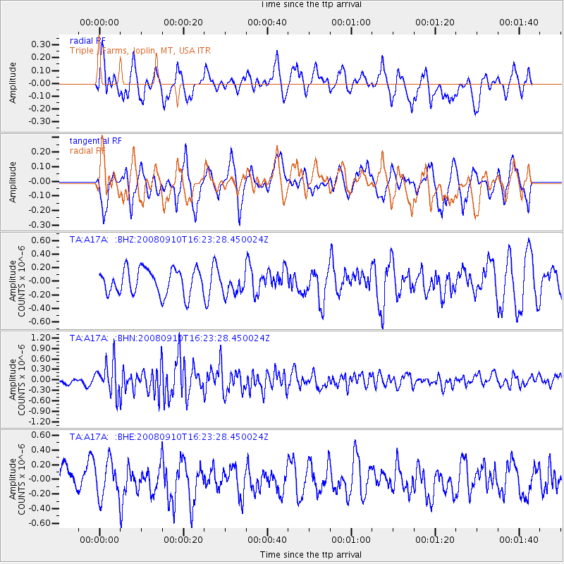
A17A Triple J Farms, Joplin, MT, USA - Earthquake Result Viewer
*The percent match for this event was below the threshold and hence no stack was calculated.
| Earthquake location: |
Northern Chile |
| Earthquake latitude/longitude: |
-20.3/-69.2 |
| Earthquake time(UTC): |
2008/09/10 (254) 16:12:04 GMT |
| Earthquake Depth: |
38 km |
| Earthquake Magnitude: |
5.6 MB, 5.3 MS |
| Earthquake Catalog/Contributor: |
WHDF/NEIC |
|
| Network: |
TA USArray Transportable Network (new EarthScope stations) |
| Station: |
A17A Triple J Farms, Joplin, MT, USA |
| Lat/Lon: |
48.94 N/110.70 W |
| Elevation: |
973 m |
|
| Distance: |
78.2 deg |
| Az: |
333.505 deg |
| Baz: |
140.558 deg |
| Ray Param: |
$rayparam |
*The percent match for this event was below the threshold and hence was not used in the summary stack. |
|
| Radial Match: |
65.64956 % |
| Radial Bump: |
400 |
| Transverse Match: |
59.91768 % |
| Transverse Bump: |
390 |
| SOD ConfigId: |
2560 |
| Insert Time: |
2010-03-06 12:51:39.893 +0000 |
| GWidth: |
2.5 |
| Max Bumps: |
400 |
| Tol: |
0.001 |
|
Signal To Noise
| Channel | StoN | STA | LTA |
| TA:A17A: :BHN:20080910T16:23:28.450024Z | 3.4526258 | 4.6345647E-7 | 1.3423305E-7 |
| TA:A17A: :BHE:20080910T16:23:28.450024Z | 1.1518239 | 2.5022658E-7 | 2.1724378E-7 |
| TA:A17A: :BHZ:20080910T16:23:28.450024Z | 0.8119802 | 1.5162286E-7 | 1.8673221E-7 |
| Arrivals |
| Ps | |
| PpPs | |
| PsPs/PpSs | |


