You are here: Home > Network List > TA - USArray Transportable Network (new EarthScope stations) Stations List
> Station A17A Triple J Farms, Joplin, MT, USA > Earthquake Result Viewer
A17A Triple J Farms, Joplin, MT, USA - Earthquake Result Viewer
*The percent match for this event was below the threshold and hence no stack was calculated.
| Earthquake location: |
Near East Coast Of Honshu, Japan |
| Earthquake latitude/longitude: |
35.5/140.9 |
| Earthquake time(UTC): |
2009/06/06 (157) 05:52:43 GMT |
| Earthquake Depth: |
34 km |
| Earthquake Magnitude: |
5.8 MB, 5.4 MS, 5.8 MW, 5.7 MW |
| Earthquake Catalog/Contributor: |
WHDF/NEIC |
|
| Network: |
TA USArray Transportable Network (new EarthScope stations) |
| Station: |
A17A Triple J Farms, Joplin, MT, USA |
| Lat/Lon: |
48.94 N/110.70 W |
| Elevation: |
973 m |
|
| Distance: |
74.6 deg |
| Az: |
40.45 deg |
| Baz: |
306.57 deg |
| Ray Param: |
$rayparam |
*The percent match for this event was below the threshold and hence was not used in the summary stack. |
|
| Radial Match: |
70.52281 % |
| Radial Bump: |
400 |
| Transverse Match: |
60.39929 % |
| Transverse Bump: |
400 |
| SOD ConfigId: |
2648 |
| Insert Time: |
2010-03-06 12:51:57.736 +0000 |
| GWidth: |
2.5 |
| Max Bumps: |
400 |
| Tol: |
0.001 |
|
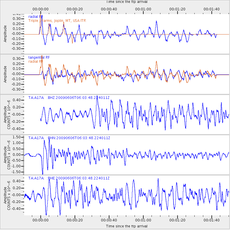
Signal To Noise
| Channel | StoN | STA | LTA |
| TA:A17A: :BHN:20090606T06:03:48.224011Z | 10.058429 | 7.9472517E-7 | 7.901086E-8 |
| TA:A17A: :BHE:20090606T06:03:48.224011Z | 2.0593703 | 2.4889258E-7 | 1.2085859E-7 |
| TA:A17A: :BHZ:20090606T06:03:48.224011Z | 2.399425 | 2.672805E-7 | 1.11393575E-7 |
| Arrivals |
| Ps | |
| PpPs | |
| PsPs/PpSs | |


