You are here: Home > Network List > TA - USArray Transportable Network (new EarthScope stations) Stations List
> Station A17A Triple J Farms, Joplin, MT, USA > Earthquake Result Viewer
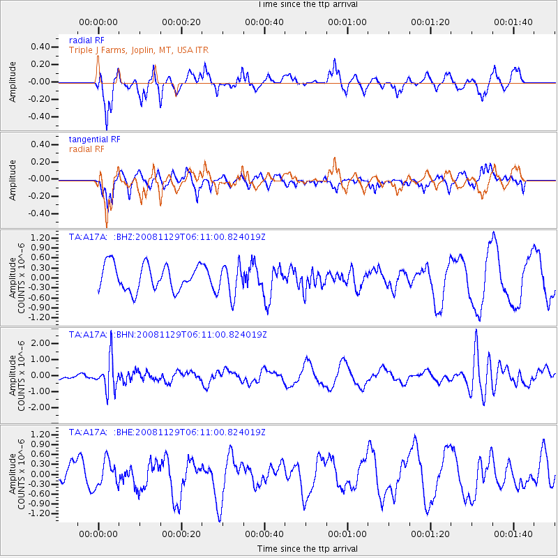
A17A Triple J Farms, Joplin, MT, USA - Earthquake Result Viewer
*The percent match for this event was below the threshold and hence no stack was calculated.
| Earthquake location: |
Fiji Islands Region |
| Earthquake latitude/longitude: |
-18.7/-177.7 |
| Earthquake time(UTC): |
2008/11/29 (334) 05:59:16 GMT |
| Earthquake Depth: |
386 km |
| Earthquake Magnitude: |
5.7 MB, 6.0 MW, 5.9 MW |
| Earthquake Catalog/Contributor: |
WHDF/NEIC |
|
| Network: |
TA USArray Transportable Network (new EarthScope stations) |
| Station: |
A17A Triple J Farms, Joplin, MT, USA |
| Lat/Lon: |
48.94 N/110.70 W |
| Elevation: |
973 m |
|
| Distance: |
89.7 deg |
| Az: |
37.37 deg |
| Baz: |
240.765 deg |
| Ray Param: |
$rayparam |
*The percent match for this event was below the threshold and hence was not used in the summary stack. |
|
| Radial Match: |
62.871952 % |
| Radial Bump: |
349 |
| Transverse Match: |
58.95847 % |
| Transverse Bump: |
381 |
| SOD ConfigId: |
2658 |
| Insert Time: |
2010-03-06 12:52:00.813 +0000 |
| GWidth: |
2.5 |
| Max Bumps: |
400 |
| Tol: |
0.001 |
|
Signal To Noise
| Channel | StoN | STA | LTA |
| TA:A17A: :BHN:20081129T06:11:00.824019Z | 3.8355658 | 1.0092145E-6 | 2.6312014E-7 |
| TA:A17A: :BHE:20081129T06:11:00.824019Z | 1.0550772 | 3.82908E-7 | 3.6291945E-7 |
| TA:A17A: :BHZ:20081129T06:11:00.824019Z | 1.2111403 | 4.6547447E-7 | 3.8432748E-7 |
| Arrivals |
| Ps | |
| PpPs | |
| PsPs/PpSs | |


