You are here: Home > Network List > CI - Caltech Regional Seismic Network Stations List
> Station MPP McPhearson Peak > Earthquake Result Viewer
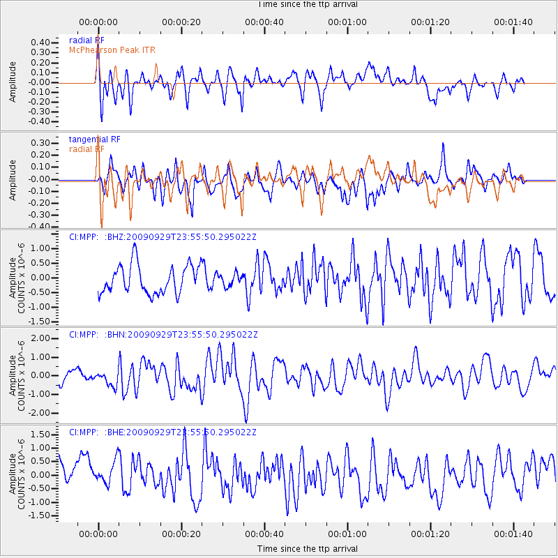
MPP McPhearson Peak - Earthquake Result Viewer
*The percent match for this event was below the threshold and hence no stack was calculated.
| Earthquake location: |
Samoa Islands Region |
| Earthquake latitude/longitude: |
-15.8/-172.6 |
| Earthquake time(UTC): |
2009/09/29 (272) 23:45:03 GMT |
| Earthquake Depth: |
10 km |
| Earthquake Magnitude: |
6.0 MB, 5.8 MS |
| Earthquake Catalog/Contributor: |
WHDF/NEIC |
|
| Network: |
CI Caltech Regional Seismic Network |
| Station: |
MPP McPhearson Peak |
| Lat/Lon: |
34.89 N/119.81 W |
| Elevation: |
1739 m |
|
| Distance: |
71.1 deg |
| Az: |
43.768 deg |
| Baz: |
234.091 deg |
| Ray Param: |
$rayparam |
*The percent match for this event was below the threshold and hence was not used in the summary stack. |
|
| Radial Match: |
59.375706 % |
| Radial Bump: |
400 |
| Transverse Match: |
53.276794 % |
| Transverse Bump: |
400 |
| SOD ConfigId: |
2622 |
| Insert Time: |
2010-02-26 02:05:36.350 +0000 |
| GWidth: |
2.5 |
| Max Bumps: |
400 |
| Tol: |
0.001 |
|
Signal To Noise
| Channel | StoN | STA | LTA |
| CI:MPP: :BHN:20090929T23:55:50.295022Z | 1.3691351 | 3.9136387E-7 | 2.858475E-7 |
| CI:MPP: :BHE:20090929T23:55:50.295022Z | 0.9835716 | 5.54595E-7 | 5.6385824E-7 |
| CI:MPP: :BHZ:20090929T23:55:50.295022Z | 0.4139791 | 2.0204132E-7 | 4.8804714E-7 |
| Arrivals |
| Ps | |
| PpPs | |
| PsPs/PpSs | |


