You are here: Home > Network List > TA - USArray Transportable Network (new EarthScope stations) Stations List
> Station A17A Triple J Farms, Joplin, MT, USA > Earthquake Result Viewer
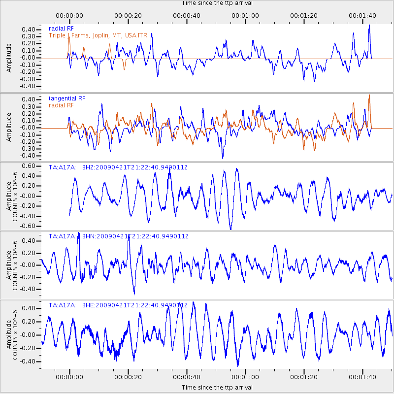
A17A Triple J Farms, Joplin, MT, USA - Earthquake Result Viewer
*The percent match for this event was below the threshold and hence no stack was calculated.
| Earthquake location: |
Santa Cruz Islands |
| Earthquake latitude/longitude: |
-10.8/166.0 |
| Earthquake time(UTC): |
2009/04/21 (111) 21:09:59 GMT |
| Earthquake Depth: |
35 km |
| Earthquake Magnitude: |
5.7 MW, 5.0 MS, 5.3 MB, 5.7 MW |
| Earthquake Catalog/Contributor: |
WHDF/NEIC |
|
| Network: |
TA USArray Transportable Network (new EarthScope stations) |
| Station: |
A17A Triple J Farms, Joplin, MT, USA |
| Lat/Lon: |
48.94 N/110.70 W |
| Elevation: |
973 m |
|
| Distance: |
93.7 deg |
| Az: |
41.003 deg |
| Baz: |
257.897 deg |
| Ray Param: |
$rayparam |
*The percent match for this event was below the threshold and hence was not used in the summary stack. |
|
| Radial Match: |
37.58801 % |
| Radial Bump: |
400 |
| Transverse Match: |
46.678425 % |
| Transverse Bump: |
400 |
| SOD ConfigId: |
2658 |
| Insert Time: |
2010-03-06 12:52:23.348 +0000 |
| GWidth: |
2.5 |
| Max Bumps: |
400 |
| Tol: |
0.001 |
|
Signal To Noise
| Channel | StoN | STA | LTA |
| TA:A17A: :BHN:20090421T21:22:40.949011Z | 2.5405736 | 2.4933547E-7 | 9.8141406E-8 |
| TA:A17A: :BHE:20090421T21:22:40.949011Z | 0.7211872 | 1.5908468E-7 | 2.2058722E-7 |
| TA:A17A: :BHZ:20090421T21:22:40.949011Z | 1.4639034 | 2.926521E-7 | 1.9991215E-7 |
| Arrivals |
| Ps | |
| PpPs | |
| PsPs/PpSs | |


