You are here: Home > Network List > TA - USArray Transportable Network (new EarthScope stations) Stations List
> Station A17A Triple J Farms, Joplin, MT, USA > Earthquake Result Viewer
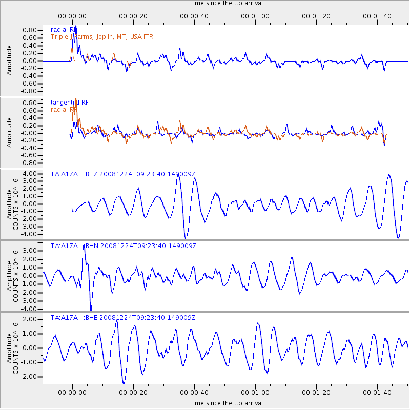
A17A Triple J Farms, Joplin, MT, USA - Earthquake Result Viewer
*The percent match for this event was below the threshold and hence no stack was calculated.
| Earthquake location: |
Tonga Islands Region |
| Earthquake latitude/longitude: |
-17.3/-171.9 |
| Earthquake time(UTC): |
2008/12/24 (359) 09:11:34 GMT |
| Earthquake Depth: |
9.0 km |
| Earthquake Magnitude: |
5.9 MB, 5.6 MS, 6.0 MW, 6.0 MW |
| Earthquake Catalog/Contributor: |
WHDF/NEIC |
|
| Network: |
TA USArray Transportable Network (new EarthScope stations) |
| Station: |
A17A Triple J Farms, Joplin, MT, USA |
| Lat/Lon: |
48.94 N/110.70 W |
| Elevation: |
973 m |
|
| Distance: |
85.3 deg |
| Az: |
35.43 deg |
| Baz: |
237.146 deg |
| Ray Param: |
$rayparam |
*The percent match for this event was below the threshold and hence was not used in the summary stack. |
|
| Radial Match: |
81.928375 % |
| Radial Bump: |
400 |
| Transverse Match: |
61.00675 % |
| Transverse Bump: |
273 |
| SOD ConfigId: |
2658 |
| Insert Time: |
2010-03-06 12:52:27.905 +0000 |
| GWidth: |
2.5 |
| Max Bumps: |
400 |
| Tol: |
0.001 |
|
Signal To Noise
| Channel | StoN | STA | LTA |
| TA:A17A: :BHN:20081224T09:23:40.149009Z | 2.8058462 | 1.5492643E-6 | 5.521558E-7 |
| TA:A17A: :BHE:20081224T09:23:40.149009Z | 0.42942202 | 2.6039137E-7 | 6.0637643E-7 |
| TA:A17A: :BHZ:20081224T09:23:40.149009Z | 1.9730563 | 1.73245E-6 | 8.78054E-7 |
| Arrivals |
| Ps | |
| PpPs | |
| PsPs/PpSs | |


