You are here: Home > Network List > CI - Caltech Regional Seismic Network Stations List
> Station MPP McPhearson Peak > Earthquake Result Viewer
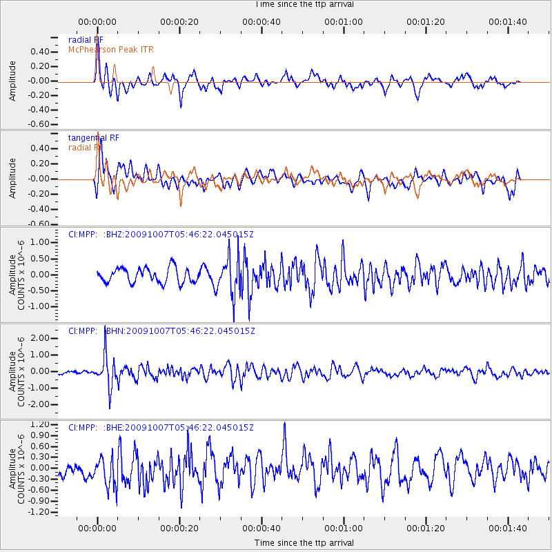
MPP McPhearson Peak - Earthquake Result Viewer
*The percent match for this event was below the threshold and hence no stack was calculated.
| Earthquake location: |
Rat Islands, Aleutian Islands |
| Earthquake latitude/longitude: |
52.2/178.1 |
| Earthquake time(UTC): |
2009/10/07 (280) 05:38:37 GMT |
| Earthquake Depth: |
138 km |
| Earthquake Magnitude: |
5.6 MB, 5.6 MW, 5.6 MW |
| Earthquake Catalog/Contributor: |
WHDF/NEIC |
|
| Network: |
CI Caltech Regional Seismic Network |
| Station: |
MPP McPhearson Peak |
| Lat/Lon: |
34.89 N/119.81 W |
| Elevation: |
1739 m |
|
| Distance: |
46.7 deg |
| Az: |
86.211 deg |
| Baz: |
311.602 deg |
| Ray Param: |
$rayparam |
*The percent match for this event was below the threshold and hence was not used in the summary stack. |
|
| Radial Match: |
69.28227 % |
| Radial Bump: |
400 |
| Transverse Match: |
51.996628 % |
| Transverse Bump: |
400 |
| SOD ConfigId: |
2622 |
| Insert Time: |
2010-02-26 02:05:37.959 +0000 |
| GWidth: |
2.5 |
| Max Bumps: |
400 |
| Tol: |
0.001 |
|
Signal To Noise
| Channel | StoN | STA | LTA |
| CI:MPP: :BHN:20091007T05:46:22.045015Z | 4.1841063 | 9.347165E-7 | 2.2339694E-7 |
| CI:MPP: :BHE:20091007T05:46:22.045015Z | 1.2149506 | 4.2467127E-7 | 3.4953788E-7 |
| CI:MPP: :BHZ:20091007T05:46:22.045015Z | 2.5788112 | 5.857582E-7 | 2.2714272E-7 |
| Arrivals |
| Ps | |
| PpPs | |
| PsPs/PpSs | |


