You are here: Home > Network List > TA - USArray Transportable Network (new EarthScope stations) Stations List
> Station A17A Triple J Farms, Joplin, MT, USA > Earthquake Result Viewer
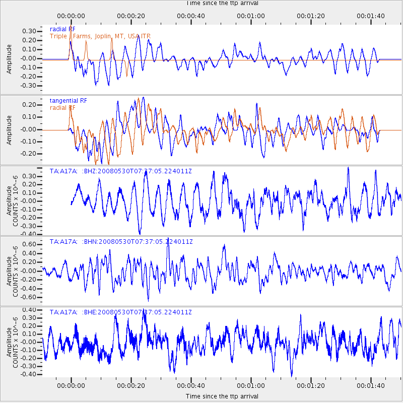
A17A Triple J Farms, Joplin, MT, USA - Earthquake Result Viewer
*The percent match for this event was below the threshold and hence no stack was calculated.
| Earthquake location: |
Southeast Of Honshu, Japan |
| Earthquake latitude/longitude: |
30.8/141.5 |
| Earthquake time(UTC): |
2008/05/30 (151) 07:25:39 GMT |
| Earthquake Depth: |
16 km |
| Earthquake Magnitude: |
5.5 MB, 5.5 MS, 5.8 MW, 5.7 MW |
| Earthquake Catalog/Contributor: |
WHDF/NEIC |
|
| Network: |
TA USArray Transportable Network (new EarthScope stations) |
| Station: |
A17A Triple J Farms, Joplin, MT, USA |
| Lat/Lon: |
48.94 N/110.70 W |
| Elevation: |
973 m |
|
| Distance: |
77.9 deg |
| Az: |
39.95 deg |
| Baz: |
303.067 deg |
| Ray Param: |
$rayparam |
*The percent match for this event was below the threshold and hence was not used in the summary stack. |
|
| Radial Match: |
42.000824 % |
| Radial Bump: |
400 |
| Transverse Match: |
51.697605 % |
| Transverse Bump: |
400 |
| SOD ConfigId: |
2504 |
| Insert Time: |
2010-03-06 12:52:55.559 +0000 |
| GWidth: |
2.5 |
| Max Bumps: |
400 |
| Tol: |
0.001 |
|
Signal To Noise
| Channel | StoN | STA | LTA |
| TA:A17A: :BHN:20080530T07:37:05.224011Z | 1.9605474 | 1.6148049E-7 | 8.2365E-8 |
| TA:A17A: :BHE:20080530T07:37:05.224011Z | 0.9062068 | 1.1398144E-7 | 1.2577863E-7 |
| TA:A17A: :BHZ:20080530T07:37:05.224011Z | 1.1836778 | 1.6815542E-7 | 1.4206182E-7 |
| Arrivals |
| Ps | |
| PpPs | |
| PsPs/PpSs | |


