You are here: Home > Network List > TA - USArray Transportable Network (new EarthScope stations) Stations List
> Station A17A Triple J Farms, Joplin, MT, USA > Earthquake Result Viewer
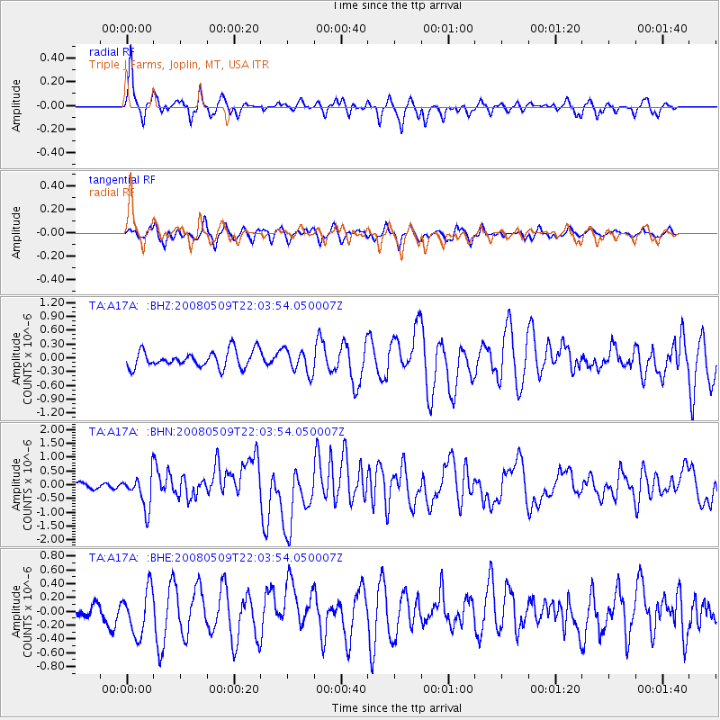
A17A Triple J Farms, Joplin, MT, USA - Earthquake Result Viewer
*The percent match for this event was below the threshold and hence no stack was calculated.
| Earthquake location: |
South Of Mariana Islands |
| Earthquake latitude/longitude: |
12.5/143.2 |
| Earthquake time(UTC): |
2008/05/09 (130) 21:51:29 GMT |
| Earthquake Depth: |
76 km |
| Earthquake Magnitude: |
6.1 MB, 6.7 MW, 6.7 MW |
| Earthquake Catalog/Contributor: |
WHDF/NEIC |
|
| Network: |
TA USArray Transportable Network (new EarthScope stations) |
| Station: |
A17A Triple J Farms, Joplin, MT, USA |
| Lat/Lon: |
48.94 N/110.70 W |
| Elevation: |
973 m |
|
| Distance: |
91.0 deg |
| Az: |
39.306 deg |
| Baz: |
290.235 deg |
| Ray Param: |
$rayparam |
*The percent match for this event was below the threshold and hence was not used in the summary stack. |
|
| Radial Match: |
76.92746 % |
| Radial Bump: |
400 |
| Transverse Match: |
68.119095 % |
| Transverse Bump: |
400 |
| SOD ConfigId: |
2504 |
| Insert Time: |
2010-03-06 12:53:42.634 +0000 |
| GWidth: |
2.5 |
| Max Bumps: |
400 |
| Tol: |
0.001 |
|
Signal To Noise
| Channel | StoN | STA | LTA |
| TA:A17A: :BHN:20080509T22:03:54.050007Z | 5.182177 | 6.239462E-7 | 1.2040233E-7 |
| TA:A17A: :BHE:20080509T22:03:54.050007Z | 3.8622599 | 3.3520604E-7 | 8.679013E-8 |
| TA:A17A: :BHZ:20080509T22:03:54.050007Z | 1.436849 | 2.603223E-7 | 1.8117582E-7 |
| Arrivals |
| Ps | |
| PpPs | |
| PsPs/PpSs | |


