
KBL Kabul, Afghanistan - Earthquake Result Viewer
| ||||||||||||||||||
| ||||||||||||||||||
| ||||||||||||||||||
|
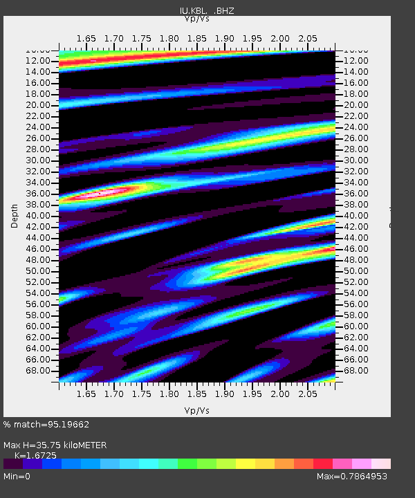
Signal To Noise
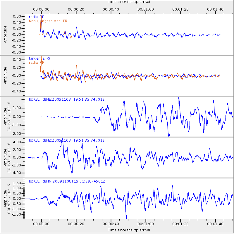
| Channel | StoN | STA | LTA |
| IU:KBL: :BHZ:20091108T19:51:39.74501Z | 27.594437 | 1.2947278E-6 | 4.6919883E-8 |
| IU:KBL: :BHN:20091108T19:51:39.74501Z | 6.33197 | 2.1271518E-7 | 3.3593835E-8 |
| IU:KBL: :BHE:20091108T19:51:39.74501Z | 17.621683 | 4.6153764E-7 | 2.6191461E-8 |
| Arrivals | |
| Ps | 3.8 SECOND |
| PpPs | 14 SECOND |
| PsPs/PpSs | 17 SECOND |

