You are here: Home > Network List > CI - Caltech Regional Seismic Network Stations List
> Station MPP McPhearson Peak > Earthquake Result Viewer
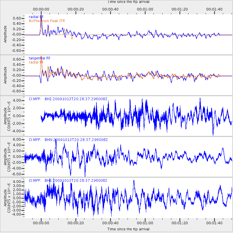
MPP McPhearson Peak - Earthquake Result Viewer
*The percent match for this event was below the threshold and hence no stack was calculated.
| Earthquake location: |
Fox Islands, Aleutian Islands |
| Earthquake latitude/longitude: |
52.6/-167.1 |
| Earthquake time(UTC): |
2009/10/13 (286) 20:21:53 GMT |
| Earthquake Depth: |
14 km |
| Earthquake Magnitude: |
5.9 MB, 6.4 MS, 6.4 MW, 6.4 MW |
| Earthquake Catalog/Contributor: |
WHDF/NEIC |
|
| Network: |
CI Caltech Regional Seismic Network |
| Station: |
MPP McPhearson Peak |
| Lat/Lon: |
34.89 N/119.81 W |
| Elevation: |
1739 m |
|
| Distance: |
37.7 deg |
| Az: |
98.889 deg |
| Baz: |
312.862 deg |
| Ray Param: |
$rayparam |
*The percent match for this event was below the threshold and hence was not used in the summary stack. |
|
| Radial Match: |
69.92324 % |
| Radial Bump: |
400 |
| Transverse Match: |
71.35233 % |
| Transverse Bump: |
400 |
| SOD ConfigId: |
2622 |
| Insert Time: |
2010-02-26 02:05:46.954 +0000 |
| GWidth: |
2.5 |
| Max Bumps: |
400 |
| Tol: |
0.001 |
|
Signal To Noise
| Channel | StoN | STA | LTA |
| CI:MPP: :BHN:20091013T20:28:37.296008Z | 3.0500462 | 1.5467406E-6 | 5.071204E-7 |
| CI:MPP: :BHE:20091013T20:28:37.296008Z | 1.53325 | 1.8352674E-6 | 1.1969787E-6 |
| CI:MPP: :BHZ:20091013T20:28:37.296008Z | 2.2361345 | 1.4815579E-6 | 6.6255313E-7 |
| Arrivals |
| Ps | |
| PpPs | |
| PsPs/PpSs | |


