You are here: Home > Network List > CI - Caltech Regional Seismic Network Stations List
> Station MPP McPhearson Peak > Earthquake Result Viewer
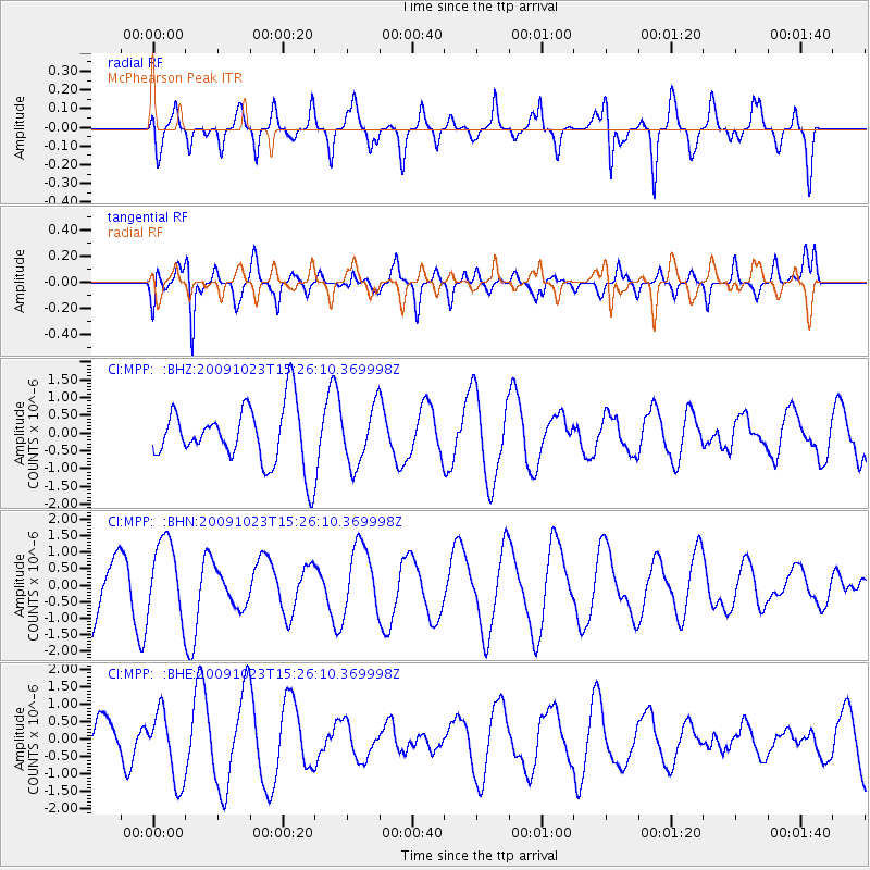
MPP McPhearson Peak - Earthquake Result Viewer
*The percent match for this event was below the threshold and hence no stack was calculated.
| Earthquake location: |
Santa Cruz Islands |
| Earthquake latitude/longitude: |
-12.2/166.0 |
| Earthquake time(UTC): |
2009/10/23 (296) 15:14:13 GMT |
| Earthquake Depth: |
31 km |
| Earthquake Magnitude: |
5.6 MB, 5.8 MS, 6.0 MW, 5.9 MW |
| Earthquake Catalog/Contributor: |
WHDF/NEIC |
|
| Network: |
CI Caltech Regional Seismic Network |
| Station: |
MPP McPhearson Peak |
| Lat/Lon: |
34.89 N/119.81 W |
| Elevation: |
1739 m |
|
| Distance: |
84.3 deg |
| Az: |
52.633 deg |
| Baz: |
250.953 deg |
| Ray Param: |
$rayparam |
*The percent match for this event was below the threshold and hence was not used in the summary stack. |
|
| Radial Match: |
43.935814 % |
| Radial Bump: |
400 |
| Transverse Match: |
59.282925 % |
| Transverse Bump: |
400 |
| SOD ConfigId: |
2622 |
| Insert Time: |
2010-02-26 02:05:50.825 +0000 |
| GWidth: |
2.5 |
| Max Bumps: |
400 |
| Tol: |
0.001 |
|
Signal To Noise
| Channel | StoN | STA | LTA |
| CI:MPP: :BHN:20091023T15:26:10.369998Z | 1.5298903 | 1.1575478E-6 | 7.5662143E-7 |
| CI:MPP: :BHE:20091023T15:26:10.369998Z | 1.034908 | 1.0064439E-6 | 9.72496E-7 |
| CI:MPP: :BHZ:20091023T15:26:10.369998Z | 0.96942836 | 7.9405714E-7 | 8.190984E-7 |
| Arrivals |
| Ps | |
| PpPs | |
| PsPs/PpSs | |


