You are here: Home > Network List > TA - USArray Transportable Network (new EarthScope stations) Stations List
> Station E20K Nigu River, AK, USA > Earthquake Result Viewer
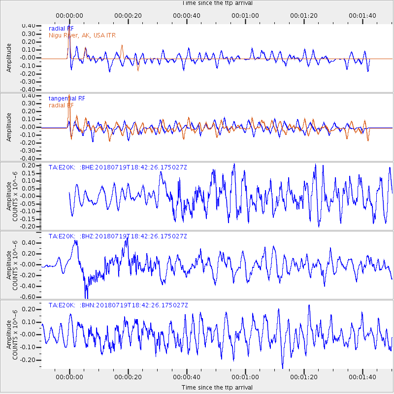
E20K Nigu River, AK, USA - Earthquake Result Viewer
*The percent match for this event was below the threshold and hence no stack was calculated.
| Earthquake location: |
New Britain Region, P.N.G. |
| Earthquake latitude/longitude: |
-6.1/148.7 |
| Earthquake time(UTC): |
2018/07/19 (200) 18:30:32 GMT |
| Earthquake Depth: |
30 km |
| Earthquake Magnitude: |
6.0 Mww |
| Earthquake Catalog/Contributor: |
NEIC PDE/us |
|
| Network: |
TA USArray Transportable Network (new EarthScope stations) |
| Station: |
E20K Nigu River, AK, USA |
| Lat/Lon: |
68.26 N/156.19 W |
| Elevation: |
866 m |
|
| Distance: |
83.5 deg |
| Az: |
17.909 deg |
| Baz: |
235.155 deg |
| Ray Param: |
$rayparam |
*The percent match for this event was below the threshold and hence was not used in the summary stack. |
|
| Radial Match: |
59.89056 % |
| Radial Bump: |
400 |
| Transverse Match: |
58.466175 % |
| Transverse Bump: |
400 |
| SOD ConfigId: |
13570011 |
| Insert Time: |
2019-04-30 14:46:38.482 +0000 |
| GWidth: |
2.5 |
| Max Bumps: |
400 |
| Tol: |
0.001 |
|
Signal To Noise
| Channel | StoN | STA | LTA |
| TA:E20K: :BHZ:20180719T18:42:26.175027Z | 4.380915 | 2.5444254E-7 | 5.8079767E-8 |
| TA:E20K: :BHN:20180719T18:42:26.175027Z | 1.7690512 | 8.62608E-8 | 4.8761052E-8 |
| TA:E20K: :BHE:20180719T18:42:26.175027Z | 1.6900179 | 8.1152194E-8 | 4.801854E-8 |
| Arrivals |
| Ps | |
| PpPs | |
| PsPs/PpSs | |


