You are here: Home > Network List > TA - USArray Transportable Network (new EarthScope stations) Stations List
> Station G21K Allakaket, AK, USA > Earthquake Result Viewer
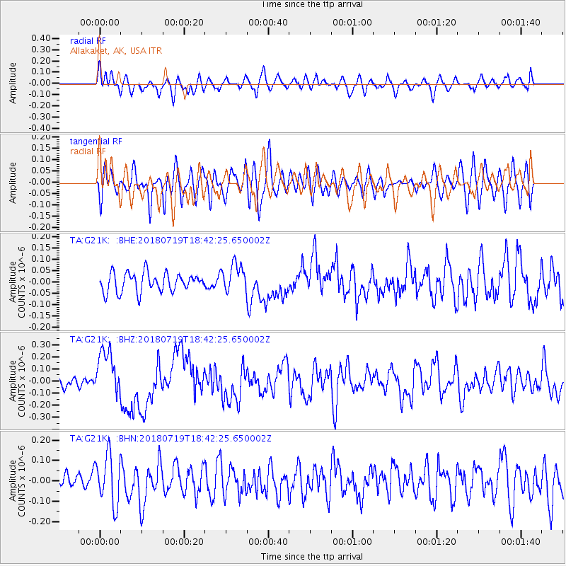
G21K Allakaket, AK, USA - Earthquake Result Viewer
*The percent match for this event was below the threshold and hence no stack was calculated.
| Earthquake location: |
New Britain Region, P.N.G. |
| Earthquake latitude/longitude: |
-6.1/148.7 |
| Earthquake time(UTC): |
2018/07/19 (200) 18:30:32 GMT |
| Earthquake Depth: |
30 km |
| Earthquake Magnitude: |
6.0 Mww |
| Earthquake Catalog/Contributor: |
NEIC PDE/us |
|
| Network: |
TA USArray Transportable Network (new EarthScope stations) |
| Station: |
G21K Allakaket, AK, USA |
| Lat/Lon: |
66.52 N/153.51 W |
| Elevation: |
446 m |
|
| Distance: |
83.4 deg |
| Az: |
19.954 deg |
| Baz: |
237.864 deg |
| Ray Param: |
$rayparam |
*The percent match for this event was below the threshold and hence was not used in the summary stack. |
|
| Radial Match: |
60.30659 % |
| Radial Bump: |
400 |
| Transverse Match: |
56.327576 % |
| Transverse Bump: |
400 |
| SOD ConfigId: |
13570011 |
| Insert Time: |
2019-04-30 14:46:57.243 +0000 |
| GWidth: |
2.5 |
| Max Bumps: |
400 |
| Tol: |
0.001 |
|
Signal To Noise
| Channel | StoN | STA | LTA |
| TA:G21K: :BHZ:20180719T18:42:25.650002Z | 3.4229047 | 1.9570278E-7 | 5.717447E-8 |
| TA:G21K: :BHN:20180719T18:42:25.650002Z | 2.7468023 | 1.2347255E-7 | 4.4951374E-8 |
| TA:G21K: :BHE:20180719T18:42:25.650002Z | 1.4996866 | 6.233241E-8 | 4.1563624E-8 |
| Arrivals |
| Ps | |
| PpPs | |
| PsPs/PpSs | |


