You are here: Home > Network List > AZ - ANZA Regional Network Stations List
> Station SMER AZ.SMER > Earthquake Result Viewer
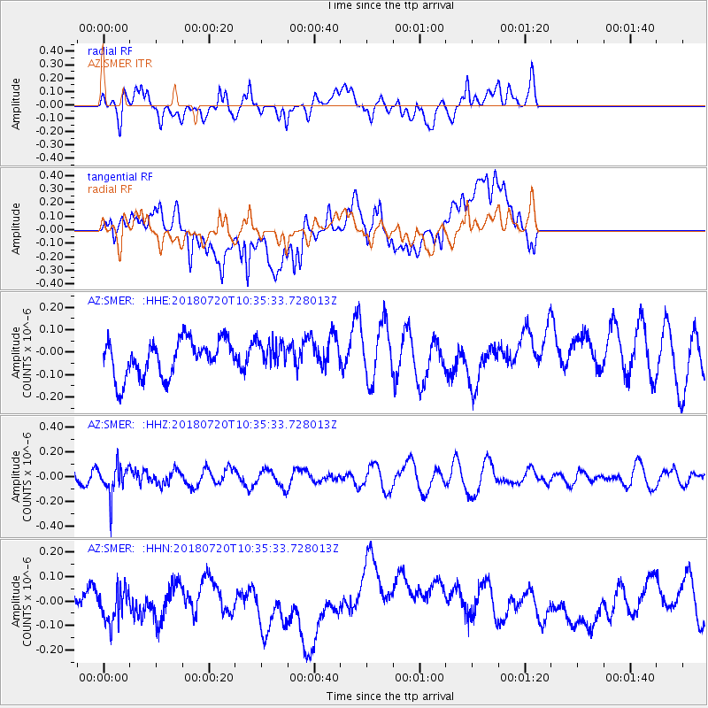
SMER AZ.SMER - Earthquake Result Viewer
*The percent match for this event was below the threshold and hence no stack was calculated.
| Earthquake location: |
Santiago Del Estero Prov., Arg. |
| Earthquake latitude/longitude: |
-28.1/-63.3 |
| Earthquake time(UTC): |
2018/07/20 (201) 10:24:57 GMT |
| Earthquake Depth: |
588 km |
| Earthquake Magnitude: |
5.6 Mww |
| Earthquake Catalog/Contributor: |
NEIC PDE/us |
|
| Network: |
AZ ANZA Regional Network |
| Station: |
SMER AZ.SMER |
| Lat/Lon: |
33.46 N/117.17 W |
| Elevation: |
355 m |
|
| Distance: |
79.7 deg |
| Az: |
316.638 deg |
| Baz: |
133.466 deg |
| Ray Param: |
$rayparam |
*The percent match for this event was below the threshold and hence was not used in the summary stack. |
|
| Radial Match: |
55.546223 % |
| Radial Bump: |
400 |
| Transverse Match: |
47.11332 % |
| Transverse Bump: |
400 |
| SOD ConfigId: |
13570011 |
| Insert Time: |
2019-04-30 14:50:01.103 +0000 |
| GWidth: |
2.5 |
| Max Bumps: |
400 |
| Tol: |
0.001 |
|
Signal To Noise
| Channel | StoN | STA | LTA |
| AZ:SMER: :HHZ:20180720T10:35:33.728013Z | 1.3040565 | 1.2191829E-7 | 9.3491565E-8 |
| AZ:SMER: :HHN:20180720T10:35:33.728013Z | 0.75336295 | 6.5868E-8 | 8.743196E-8 |
| AZ:SMER: :HHE:20180720T10:35:33.728013Z | 0.7190095 | 5.844303E-8 | 8.128269E-8 |
| Arrivals |
| Ps | |
| PpPs | |
| PsPs/PpSs | |


