You are here: Home > Network List > CI - Caltech Regional Seismic Network Stations List
> Station MPP McPhearson Peak > Earthquake Result Viewer
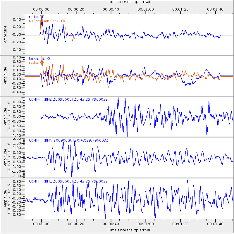
MPP McPhearson Peak - Earthquake Result Viewer
*The percent match for this event was below the threshold and hence no stack was calculated.
| Earthquake location: |
Northern Mid-Atlantic Ridge |
| Earthquake latitude/longitude: |
23.9/-46.1 |
| Earthquake time(UTC): |
2009/06/06 (157) 20:33:28 GMT |
| Earthquake Depth: |
14 km |
| Earthquake Magnitude: |
6.0 MB, 5.7 MS, 6.0 MW, 6.0 MW |
| Earthquake Catalog/Contributor: |
WHDF/NEIC |
|
| Network: |
CI Caltech Regional Seismic Network |
| Station: |
MPP McPhearson Peak |
| Lat/Lon: |
34.89 N/119.81 W |
| Elevation: |
1739 m |
|
| Distance: |
63.9 deg |
| Az: |
298.505 deg |
| Baz: |
78.144 deg |
| Ray Param: |
$rayparam |
*The percent match for this event was below the threshold and hence was not used in the summary stack. |
|
| Radial Match: |
79.57375 % |
| Radial Bump: |
400 |
| Transverse Match: |
52.995354 % |
| Transverse Bump: |
400 |
| SOD ConfigId: |
2648 |
| Insert Time: |
2010-02-26 02:05:55.805 +0000 |
| GWidth: |
2.5 |
| Max Bumps: |
400 |
| Tol: |
0.001 |
|
Signal To Noise
| Channel | StoN | STA | LTA |
| CI:MPP: :BHN:20090606T20:43:29.796003Z | 5.603164 | 3.084619E-7 | 5.5051373E-8 |
| CI:MPP: :BHE:20090606T20:43:29.796003Z | 0.91360784 | 2.457521E-7 | 2.689908E-7 |
| CI:MPP: :BHZ:20090606T20:43:29.796003Z | 1.3464491 | 1.2367477E-7 | 9.185254E-8 |
| Arrivals |
| Ps | |
| PpPs | |
| PsPs/PpSs | |


