You are here: Home > Network List > TA - USArray Transportable Network (new EarthScope stations) Stations List
> Station 222A Williams Family Ranch, Las Cruces, NM, USA > Earthquake Result Viewer
222A Williams Family Ranch, Las Cruces, NM, USA - Earthquake Result Viewer

| Earthquake location: |
Near Coast Of Venezuela |
| Earthquake latitude/longitude: |
10.7/-67.9 |
| Earthquake time(UTC): |
2009/09/12 (255) 20:06:24 GMT |
| Earthquake Depth: |
10 km |
| Earthquake Magnitude: |
6.3 MB, 6.4 MS, 6.3 MW, 6.3 MW |
| Earthquake Catalog/Contributor: |
WHDF/NEIC |
|
| Network: |
TA USArray Transportable Network (new EarthScope stations) |
| Station: |
222A Williams Family Ranch, Las Cruces, NM, USA |
| Lat/Lon: |
32.10 N/107.10 W |
| Elevation: |
1324 m |
|
| Distance: |
41.9 deg |
| Az: |
306.615 deg |
| Baz: |
111.638 deg |
| Ray Param: |
0.073490426 |
| Estimated Moho Depth: |
25.75 km |
| Estimated Crust Vp/Vs: |
2.06 |
| Assumed Crust Vp: |
6.502 km/s |
| Estimated Crust Vs: |
3.16 km/s |
| Estimated Crust Poisson's Ratio: |
0.35 |
|
| Radial Match: |
91.05537 % |
| Radial Bump: |
309 |
| Transverse Match: |
80.86439 % |
| Transverse Bump: |
400 |
| SOD ConfigId: |
2622 |
| Insert Time: |
2010-03-06 12:56:54.020 +0000 |
| GWidth: |
2.5 |
| Max Bumps: |
400 |
| Tol: |
0.001 |
|
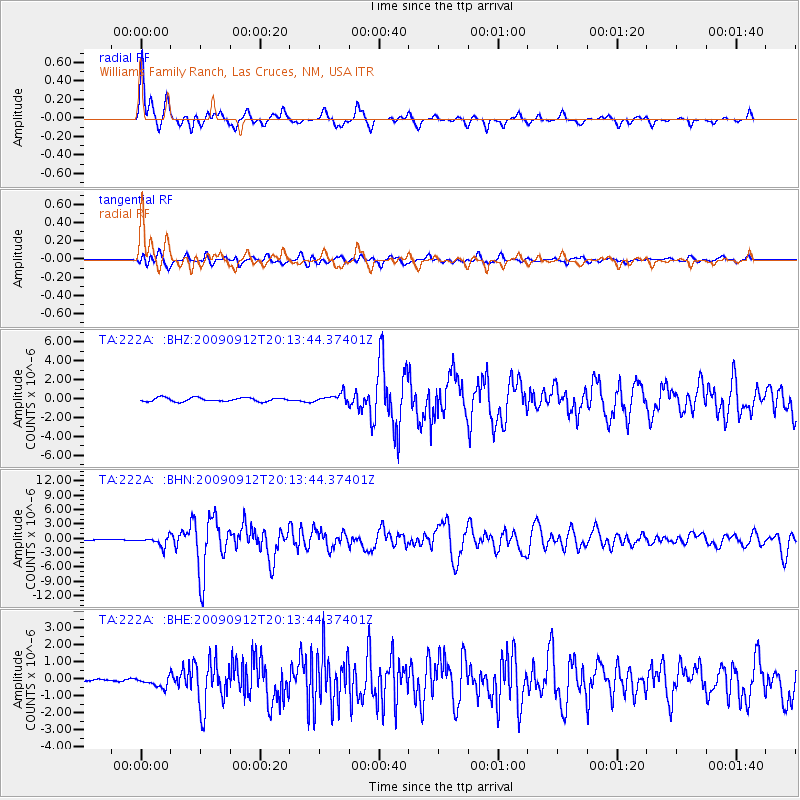
Signal To Noise
| Channel | StoN | STA | LTA |
| TA:222A: :BHN:20090912T20:13:44.37401Z | 6.607811 | 1.0059583E-6 | 1.5223776E-7 |
| TA:222A: :BHE:20090912T20:13:44.37401Z | 2.3935618 | 3.0062742E-7 | 1.2559835E-7 |
| TA:222A: :BHZ:20090912T20:13:44.37401Z | 2.3389792 | 4.7452616E-7 | 2.0287744E-7 |
| Arrivals |
| Ps | 4.4 SECOND |
| PpPs | 11 SECOND |
| PsPs/PpSs | 16 SECOND |


