You are here: Home > Network List > TA - USArray Transportable Network (new EarthScope stations) Stations List
> Station MDND Maddock, ND, USA > Earthquake Result Viewer
MDND Maddock, ND, USA - Earthquake Result Viewer
*The percent match for this event was below the threshold and hence no stack was calculated.
| Earthquake location: |
Santiago Del Estero Prov., Arg. |
| Earthquake latitude/longitude: |
-28.1/-63.3 |
| Earthquake time(UTC): |
2018/07/20 (201) 10:24:57 GMT |
| Earthquake Depth: |
588 km |
| Earthquake Magnitude: |
5.6 Mww |
| Earthquake Catalog/Contributor: |
NEIC PDE/us |
|
| Network: |
TA USArray Transportable Network (new EarthScope stations) |
| Station: |
MDND Maddock, ND, USA |
| Lat/Lon: |
47.85 N/99.60 W |
| Elevation: |
479 m |
|
| Distance: |
82.3 deg |
| Az: |
336.245 deg |
| Baz: |
148.097 deg |
| Ray Param: |
$rayparam |
*The percent match for this event was below the threshold and hence was not used in the summary stack. |
|
| Radial Match: |
66.347145 % |
| Radial Bump: |
400 |
| Transverse Match: |
58.568047 % |
| Transverse Bump: |
381 |
| SOD ConfigId: |
13570011 |
| Insert Time: |
2019-04-30 14:56:39.011 +0000 |
| GWidth: |
2.5 |
| Max Bumps: |
400 |
| Tol: |
0.001 |
|
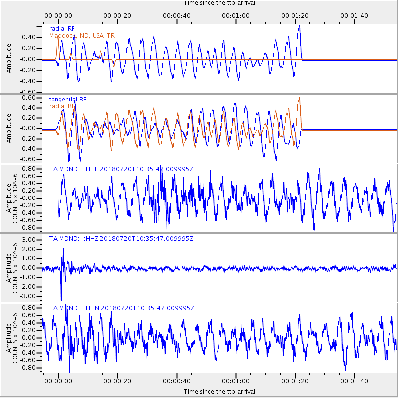
Signal To Noise
| Channel | StoN | STA | LTA |
| TA:MDND: :HHZ:20180720T10:35:47.009995Z | 7.588906 | 8.469815E-7 | 1.11607854E-7 |
| TA:MDND: :HHN:20180720T10:35:47.009995Z | 1.203582 | 4.0309175E-7 | 3.3491008E-7 |
| TA:MDND: :HHE:20180720T10:35:47.009995Z | 1.2815487 | 3.45462E-7 | 2.6956602E-7 |
| Arrivals |
| Ps | |
| PpPs | |
| PsPs/PpSs | |


