You are here: Home > Network List > TA - USArray Transportable Network (new EarthScope stations) Stations List
> Station 222A Williams Family Ranch, Las Cruces, NM, USA > Earthquake Result Viewer
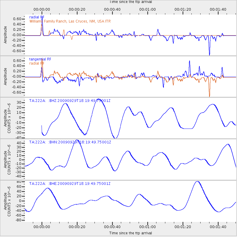
222A Williams Family Ranch, Las Cruces, NM, USA - Earthquake Result Viewer
*The percent match for this event was below the threshold and hence no stack was calculated.
| Earthquake location: |
Samoa Islands Region |
| Earthquake latitude/longitude: |
-15.6/-172.0 |
| Earthquake time(UTC): |
2009/09/29 (272) 18:08:21 GMT |
| Earthquake Depth: |
10 km |
| Earthquake Magnitude: |
5.6 MB |
| Earthquake Catalog/Contributor: |
WHDF/NEIC |
|
| Network: |
TA USArray Transportable Network (new EarthScope stations) |
| Station: |
222A Williams Family Ranch, Las Cruces, NM, USA |
| Lat/Lon: |
32.10 N/107.10 W |
| Elevation: |
1324 m |
|
| Distance: |
78.1 deg |
| Az: |
51.762 deg |
| Baz: |
243.127 deg |
| Ray Param: |
$rayparam |
*The percent match for this event was below the threshold and hence was not used in the summary stack. |
|
| Radial Match: |
76.2094 % |
| Radial Bump: |
400 |
| Transverse Match: |
45.312134 % |
| Transverse Bump: |
381 |
| SOD ConfigId: |
2622 |
| Insert Time: |
2010-03-06 12:58:25.678 +0000 |
| GWidth: |
2.5 |
| Max Bumps: |
400 |
| Tol: |
0.001 |
|
Signal To Noise
| Channel | StoN | STA | LTA |
| TA:222A: :BHN:20090929T18:19:49.75001Z | 0.4051577 | 1.0565818E-5 | 2.6078287E-5 |
| TA:222A: :BHE:20090929T18:19:49.75001Z | 3.0902257 | 5.4276155E-5 | 1.7563816E-5 |
| TA:222A: :BHZ:20090929T18:19:49.75001Z | 1.885038 | 3.8309885E-5 | 2.0323136E-5 |
| Arrivals |
| Ps | |
| PpPs | |
| PsPs/PpSs | |


