You are here: Home > Network List > CI - Caltech Regional Seismic Network Stations List
> Station MUR Murrieta > Earthquake Result Viewer
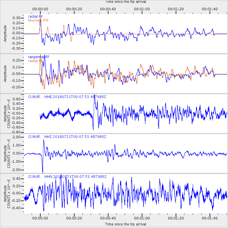
MUR Murrieta - Earthquake Result Viewer
*The percent match for this event was below the threshold and hence no stack was calculated.
| Earthquake location: |
Mariana Islands |
| Earthquake latitude/longitude: |
18.5/146.0 |
| Earthquake time(UTC): |
2018/07/20 (201) 23:56:00 GMT |
| Earthquake Depth: |
126 km |
| Earthquake Magnitude: |
5.6 Mww |
| Earthquake Catalog/Contributor: |
NEIC PDE/us |
|
| Network: |
CI Caltech Regional Seismic Network |
| Station: |
MUR Murrieta |
| Lat/Lon: |
33.60 N/117.20 W |
| Elevation: |
562 m |
|
| Distance: |
85.4 deg |
| Az: |
56.241 deg |
| Baz: |
289.016 deg |
| Ray Param: |
$rayparam |
*The percent match for this event was below the threshold and hence was not used in the summary stack. |
|
| Radial Match: |
67.29383 % |
| Radial Bump: |
400 |
| Transverse Match: |
63.112118 % |
| Transverse Bump: |
400 |
| SOD ConfigId: |
13570011 |
| Insert Time: |
2019-04-30 15:02:47.152 +0000 |
| GWidth: |
2.5 |
| Max Bumps: |
400 |
| Tol: |
0.001 |
|
Signal To Noise
| Channel | StoN | STA | LTA |
| CI:MUR: :HHZ:20180721T00:07:53.487986Z | 6.1672187 | 8.0558704E-7 | 1.3062404E-7 |
| CI:MUR: :HHN:20180721T00:07:53.487986Z | 1.5246867 | 2.0537783E-7 | 1.3470166E-7 |
| CI:MUR: :HHE:20180721T00:07:53.487986Z | 3.7107975 | 3.6949947E-7 | 9.957414E-8 |
| Arrivals |
| Ps | |
| PpPs | |
| PsPs/PpSs | |


