You are here: Home > Network List > CI - Caltech Regional Seismic Network Stations List
> Station TIN Tinemaha, Big Pine, CA, USA > Earthquake Result Viewer
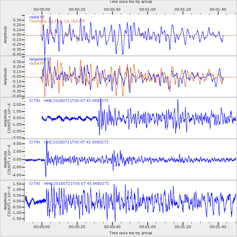
TIN Tinemaha, Big Pine, CA, USA - Earthquake Result Viewer
*The percent match for this event was below the threshold and hence no stack was calculated.
| Earthquake location: |
Mariana Islands |
| Earthquake latitude/longitude: |
18.5/146.0 |
| Earthquake time(UTC): |
2018/07/20 (201) 23:56:00 GMT |
| Earthquake Depth: |
126 km |
| Earthquake Magnitude: |
5.6 Mww |
| Earthquake Catalog/Contributor: |
NEIC PDE/us |
|
| Network: |
CI Caltech Regional Seismic Network |
| Station: |
TIN Tinemaha, Big Pine, CA, USA |
| Lat/Lon: |
37.05 N/118.23 W |
| Elevation: |
1197 m |
|
| Distance: |
83.5 deg |
| Az: |
53.23 deg |
| Baz: |
288.13 deg |
| Ray Param: |
$rayparam |
*The percent match for this event was below the threshold and hence was not used in the summary stack. |
|
| Radial Match: |
72.75164 % |
| Radial Bump: |
400 |
| Transverse Match: |
72.9586 % |
| Transverse Bump: |
400 |
| SOD ConfigId: |
13570011 |
| Insert Time: |
2019-04-30 15:03:04.497 +0000 |
| GWidth: |
2.5 |
| Max Bumps: |
400 |
| Tol: |
0.001 |
|
Signal To Noise
| Channel | StoN | STA | LTA |
| CI:TIN: :HHZ:20180721T00:07:43.968027Z | 11.072528 | 1.5835577E-6 | 1.430168E-7 |
| CI:TIN: :HHN:20180721T00:07:43.968027Z | 2.4867136 | 5.192334E-7 | 2.0880307E-7 |
| CI:TIN: :HHE:20180721T00:07:43.968027Z | 5.643689 | 1.0634785E-6 | 1.8843674E-7 |
| Arrivals |
| Ps | |
| PpPs | |
| PsPs/PpSs | |


