You are here: Home > Network List > TA - USArray Transportable Network (new EarthScope stations) Stations List
> Station H16K Elim, AK, USA > Earthquake Result Viewer
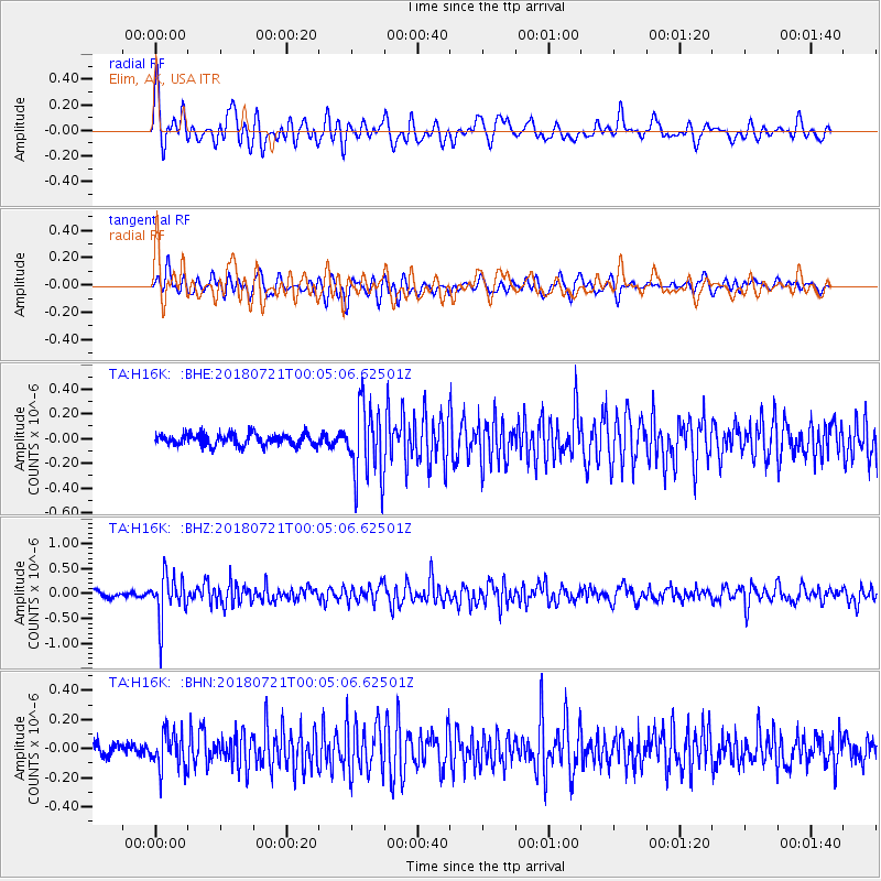
H16K Elim, AK, USA - Earthquake Result Viewer
*The percent match for this event was below the threshold and hence no stack was calculated.
| Earthquake location: |
Mariana Islands |
| Earthquake latitude/longitude: |
18.5/146.0 |
| Earthquake time(UTC): |
2018/07/20 (201) 23:56:00 GMT |
| Earthquake Depth: |
126 km |
| Earthquake Magnitude: |
5.6 Mww |
| Earthquake Catalog/Contributor: |
NEIC PDE/us |
|
| Network: |
TA USArray Transportable Network (new EarthScope stations) |
| Station: |
H16K Elim, AK, USA |
| Lat/Lon: |
64.64 N/162.24 W |
| Elevation: |
216 m |
|
| Distance: |
57.5 deg |
| Az: |
23.645 deg |
| Baz: |
242.112 deg |
| Ray Param: |
$rayparam |
*The percent match for this event was below the threshold and hence was not used in the summary stack. |
|
| Radial Match: |
75.035835 % |
| Radial Bump: |
400 |
| Transverse Match: |
68.76285 % |
| Transverse Bump: |
400 |
| SOD ConfigId: |
13570011 |
| Insert Time: |
2019-04-30 15:07:46.000 +0000 |
| GWidth: |
2.5 |
| Max Bumps: |
400 |
| Tol: |
0.001 |
|
Signal To Noise
| Channel | StoN | STA | LTA |
| TA:H16K: :BHZ:20180721T00:05:06.62501Z | 6.6859193 | 4.300144E-7 | 6.4316424E-8 |
| TA:H16K: :BHN:20180721T00:05:06.62501Z | 2.6642456 | 1.248099E-7 | 4.6846246E-8 |
| TA:H16K: :BHE:20180721T00:05:06.62501Z | 5.906863 | 2.76248E-7 | 4.676729E-8 |
| Arrivals |
| Ps | |
| PpPs | |
| PsPs/PpSs | |


