You are here: Home > Network List > TA - USArray Transportable Network (new EarthScope stations) Stations List
> Station MDND Maddock, ND, USA > Earthquake Result Viewer
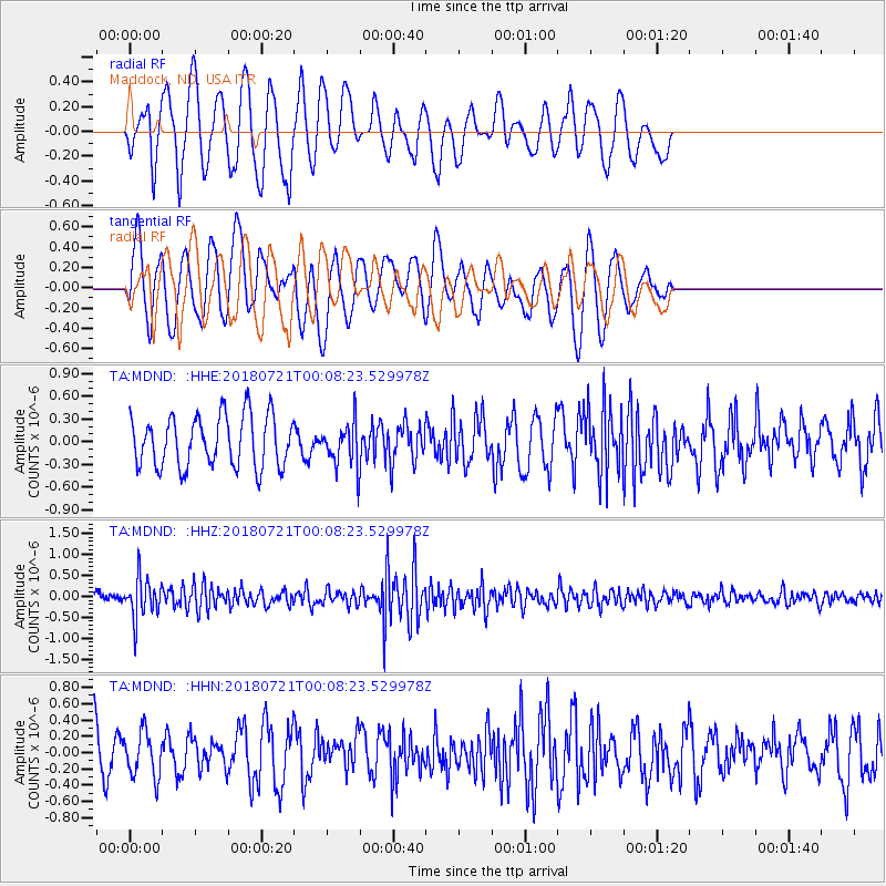
MDND Maddock, ND, USA - Earthquake Result Viewer
*The percent match for this event was below the threshold and hence no stack was calculated.
| Earthquake location: |
Mariana Islands |
| Earthquake latitude/longitude: |
18.5/146.0 |
| Earthquake time(UTC): |
2018/07/20 (201) 23:56:00 GMT |
| Earthquake Depth: |
126 km |
| Earthquake Magnitude: |
5.6 Mww |
| Earthquake Catalog/Contributor: |
NEIC PDE/us |
|
| Network: |
TA USArray Transportable Network (new EarthScope stations) |
| Station: |
MDND Maddock, ND, USA |
| Lat/Lon: |
47.85 N/99.60 W |
| Elevation: |
479 m |
|
| Distance: |
91.8 deg |
| Az: |
37.859 deg |
| Baz: |
300.142 deg |
| Ray Param: |
$rayparam |
*The percent match for this event was below the threshold and hence was not used in the summary stack. |
|
| Radial Match: |
55.21695 % |
| Radial Bump: |
400 |
| Transverse Match: |
52.73333 % |
| Transverse Bump: |
400 |
| SOD ConfigId: |
13570011 |
| Insert Time: |
2019-04-30 15:08:38.002 +0000 |
| GWidth: |
2.5 |
| Max Bumps: |
400 |
| Tol: |
0.001 |
|
Signal To Noise
| Channel | StoN | STA | LTA |
| TA:MDND: :HHZ:20180721T00:08:23.529978Z | 4.7326236 | 4.7168623E-7 | 9.966697E-8 |
| TA:MDND: :HHN:20180721T00:08:23.529978Z | 0.73384434 | 2.7459026E-7 | 3.7418053E-7 |
| TA:MDND: :HHE:20180721T00:08:23.529978Z | 0.73753023 | 2.4954332E-7 | 3.3834996E-7 |
| Arrivals |
| Ps | |
| PpPs | |
| PsPs/PpSs | |


