You are here: Home > Network List > TA - USArray Transportable Network (new EarthScope stations) Stations List
> Station R33M Jennings River, BC, CAN > Earthquake Result Viewer
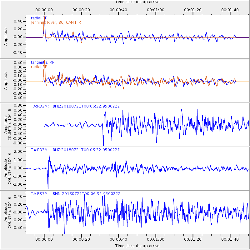
R33M Jennings River, BC, CAN - Earthquake Result Viewer
*The percent match for this event was below the threshold and hence no stack was calculated.
| Earthquake location: |
Mariana Islands |
| Earthquake latitude/longitude: |
18.5/146.0 |
| Earthquake time(UTC): |
2018/07/20 (201) 23:56:00 GMT |
| Earthquake Depth: |
126 km |
| Earthquake Magnitude: |
5.6 Mww |
| Earthquake Catalog/Contributor: |
NEIC PDE/us |
|
| Network: |
TA USArray Transportable Network (new EarthScope stations) |
| Station: |
R33M Jennings River, BC, CAN |
| Lat/Lon: |
59.39 N/130.97 W |
| Elevation: |
1437 m |
|
| Distance: |
70.8 deg |
| Az: |
32.542 deg |
| Baz: |
273.779 deg |
| Ray Param: |
$rayparam |
*The percent match for this event was below the threshold and hence was not used in the summary stack. |
|
| Radial Match: |
74.05569 % |
| Radial Bump: |
400 |
| Transverse Match: |
73.93817 % |
| Transverse Bump: |
400 |
| SOD ConfigId: |
13570011 |
| Insert Time: |
2019-04-30 15:09:14.121 +0000 |
| GWidth: |
2.5 |
| Max Bumps: |
400 |
| Tol: |
0.001 |
|
Signal To Noise
| Channel | StoN | STA | LTA |
| TA:R33M: :BHZ:20180721T00:06:32.950022Z | 13.691408 | 7.6316525E-7 | 5.5740447E-8 |
| TA:R33M: :BHN:20180721T00:06:32.950022Z | 2.5389543 | 1.5745549E-7 | 6.2015886E-8 |
| TA:R33M: :BHE:20180721T00:06:32.950022Z | 5.1950154 | 2.8846742E-7 | 5.5527728E-8 |
| Arrivals |
| Ps | |
| PpPs | |
| PsPs/PpSs | |


