You are here: Home > Network List > TA - USArray Transportable Network (new EarthScope stations) Stations List
> Station T25A Trinidad, CO, USA > Earthquake Result Viewer
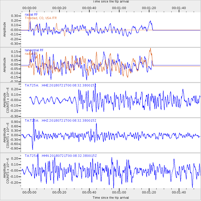
T25A Trinidad, CO, USA - Earthquake Result Viewer
*The percent match for this event was below the threshold and hence no stack was calculated.
| Earthquake location: |
Mariana Islands |
| Earthquake latitude/longitude: |
18.5/146.0 |
| Earthquake time(UTC): |
2018/07/20 (201) 23:56:00 GMT |
| Earthquake Depth: |
126 km |
| Earthquake Magnitude: |
5.6 Mww |
| Earthquake Catalog/Contributor: |
NEIC PDE/us |
|
| Network: |
TA USArray Transportable Network (new EarthScope stations) |
| Station: |
T25A Trinidad, CO, USA |
| Lat/Lon: |
37.14 N/104.41 W |
| Elevation: |
2017 m |
|
| Distance: |
93.7 deg |
| Az: |
48.978 deg |
| Baz: |
296.354 deg |
| Ray Param: |
$rayparam |
*The percent match for this event was below the threshold and hence was not used in the summary stack. |
|
| Radial Match: |
55.597557 % |
| Radial Bump: |
400 |
| Transverse Match: |
70.25892 % |
| Transverse Bump: |
400 |
| SOD ConfigId: |
13570011 |
| Insert Time: |
2019-04-30 15:09:20.905 +0000 |
| GWidth: |
2.5 |
| Max Bumps: |
400 |
| Tol: |
0.001 |
|
Signal To Noise
| Channel | StoN | STA | LTA |
| TA:T25A: :HHZ:20180721T00:08:32.380015Z | 6.409232 | 4.0064057E-7 | 6.250992E-8 |
| TA:T25A: :HHN:20180721T00:08:32.380015Z | 0.9506615 | 5.705362E-8 | 6.001465E-8 |
| TA:T25A: :HHE:20180721T00:08:32.380015Z | 2.7937791 | 1.09671355E-7 | 3.9255557E-8 |
| Arrivals |
| Ps | |
| PpPs | |
| PsPs/PpSs | |


