You are here: Home > Network List > UW - Pacific Northwest Regional Seismic Network Stations List
> Station LEBA Lebam, WA, USA > Earthquake Result Viewer
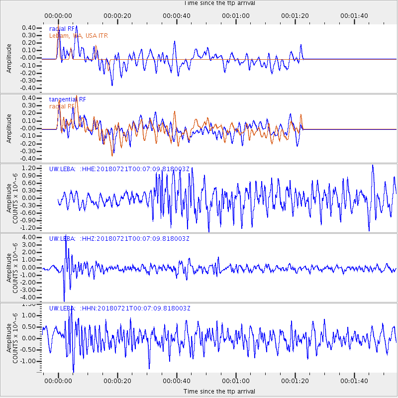
LEBA Lebam, WA, USA - Earthquake Result Viewer
*The percent match for this event was below the threshold and hence no stack was calculated.
| Earthquake location: |
Mariana Islands |
| Earthquake latitude/longitude: |
18.5/146.0 |
| Earthquake time(UTC): |
2018/07/20 (201) 23:56:00 GMT |
| Earthquake Depth: |
126 km |
| Earthquake Magnitude: |
5.6 Mww |
| Earthquake Catalog/Contributor: |
NEIC PDE/us |
|
| Network: |
UW Pacific Northwest Regional Seismic Network |
| Station: |
LEBA Lebam, WA, USA |
| Lat/Lon: |
46.55 N/123.56 W |
| Elevation: |
73 m |
|
| Distance: |
77.1 deg |
| Az: |
45.072 deg |
| Baz: |
283.2 deg |
| Ray Param: |
$rayparam |
*The percent match for this event was below the threshold and hence was not used in the summary stack. |
|
| Radial Match: |
63.2938 % |
| Radial Bump: |
400 |
| Transverse Match: |
63.081413 % |
| Transverse Bump: |
400 |
| SOD ConfigId: |
13570011 |
| Insert Time: |
2019-04-30 15:10:28.136 +0000 |
| GWidth: |
2.5 |
| Max Bumps: |
400 |
| Tol: |
0.001 |
|
Signal To Noise
| Channel | StoN | STA | LTA |
| UW:LEBA: :HHZ:20180721T00:07:09.818003Z | 6.641159 | 1.676983E-6 | 2.525136E-7 |
| UW:LEBA: :HHN:20180721T00:07:09.818003Z | 1.4864509 | 5.9721725E-7 | 4.0177397E-7 |
| UW:LEBA: :HHE:20180721T00:07:09.818003Z | 2.459753 | 4.7555304E-7 | 1.9333365E-7 |
| Arrivals |
| Ps | |
| PpPs | |
| PsPs/PpSs | |


