You are here: Home > Network List > UW - Pacific Northwest Regional Seismic Network Stations List
> Station UMAT Pilot Rock, OR, USA > Earthquake Result Viewer
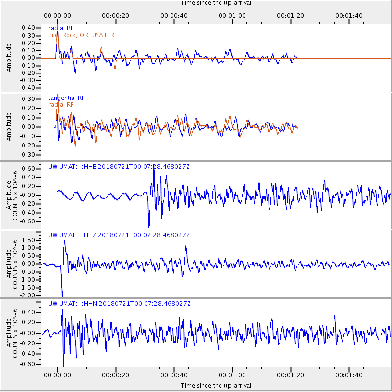
UMAT Pilot Rock, OR, USA - Earthquake Result Viewer
*The percent match for this event was below the threshold and hence no stack was calculated.
| Earthquake location: |
Mariana Islands |
| Earthquake latitude/longitude: |
18.5/146.0 |
| Earthquake time(UTC): |
2018/07/20 (201) 23:56:00 GMT |
| Earthquake Depth: |
126 km |
| Earthquake Magnitude: |
5.6 Mww |
| Earthquake Catalog/Contributor: |
NEIC PDE/us |
|
| Network: |
UW Pacific Northwest Regional Seismic Network |
| Station: |
UMAT Pilot Rock, OR, USA |
| Lat/Lon: |
45.29 N/118.96 W |
| Elevation: |
1318 m |
|
| Distance: |
80.6 deg |
| Az: |
45.466 deg |
| Baz: |
286.574 deg |
| Ray Param: |
$rayparam |
*The percent match for this event was below the threshold and hence was not used in the summary stack. |
|
| Radial Match: |
74.11943 % |
| Radial Bump: |
400 |
| Transverse Match: |
65.474915 % |
| Transverse Bump: |
400 |
| SOD ConfigId: |
13570011 |
| Insert Time: |
2019-04-30 15:10:41.027 +0000 |
| GWidth: |
2.5 |
| Max Bumps: |
400 |
| Tol: |
0.001 |
|
Signal To Noise
| Channel | StoN | STA | LTA |
| UW:UMAT: :HHZ:20180721T00:07:28.468027Z | 11.121567 | 7.1968E-7 | 6.47103E-8 |
| UW:UMAT: :HHN:20180721T00:07:28.468027Z | 3.9374533 | 2.2150259E-7 | 5.6255296E-8 |
| UW:UMAT: :HHE:20180721T00:07:28.468027Z | 4.657807 | 2.790074E-7 | 5.9901026E-8 |
| Arrivals |
| Ps | |
| PpPs | |
| PsPs/PpSs | |


