You are here: Home > Network List > TA - USArray Transportable Network (new EarthScope stations) Stations List
> Station P17K Kvichak River, AK, USA > Earthquake Result Viewer
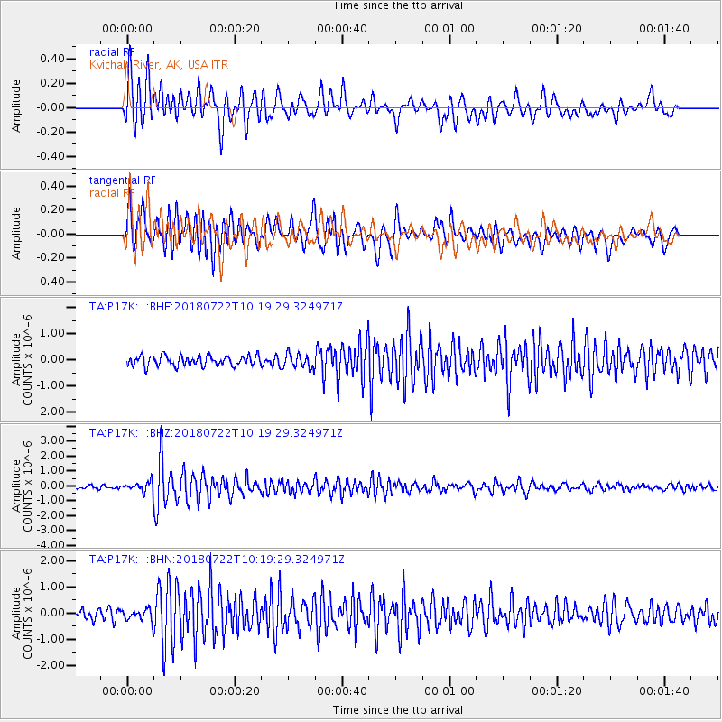
P17K Kvichak River, AK, USA - Earthquake Result Viewer
*The percent match for this event was below the threshold and hence no stack was calculated.
| Earthquake location: |
Western Iran |
| Earthquake latitude/longitude: |
34.6/46.2 |
| Earthquake time(UTC): |
2018/07/22 (203) 10:07:27 GMT |
| Earthquake Depth: |
12 km |
| Earthquake Magnitude: |
5.8 Mww |
| Earthquake Catalog/Contributor: |
NEIC PDE/us |
|
| Network: |
TA USArray Transportable Network (new EarthScope stations) |
| Station: |
P17K Kvichak River, AK, USA |
| Lat/Lon: |
59.20 N/156.44 W |
| Elevation: |
91 m |
|
| Distance: |
84.7 deg |
| Az: |
11.46 deg |
| Baz: |
341.429 deg |
| Ray Param: |
$rayparam |
*The percent match for this event was below the threshold and hence was not used in the summary stack. |
|
| Radial Match: |
85.14957 % |
| Radial Bump: |
400 |
| Transverse Match: |
82.84583 % |
| Transverse Bump: |
400 |
| SOD ConfigId: |
13570011 |
| Insert Time: |
2019-04-30 15:24:05.031 +0000 |
| GWidth: |
2.5 |
| Max Bumps: |
400 |
| Tol: |
0.001 |
|
Signal To Noise
| Channel | StoN | STA | LTA |
| TA:P17K: :BHZ:20180722T10:19:29.324971Z | 3.6107092 | 3.1555754E-7 | 8.7394895E-8 |
| TA:P17K: :BHN:20180722T10:19:29.324971Z | 1.0140499 | 2.2734288E-7 | 2.24193E-7 |
| TA:P17K: :BHE:20180722T10:19:29.324971Z | 1.3692849 | 2.6193754E-7 | 1.9129514E-7 |
| Arrivals |
| Ps | |
| PpPs | |
| PsPs/PpSs | |


