You are here: Home > Network List > TA - USArray Transportable Network (new EarthScope stations) Stations List
> Station G16K Koyuk River, AK, USA > Earthquake Result Viewer
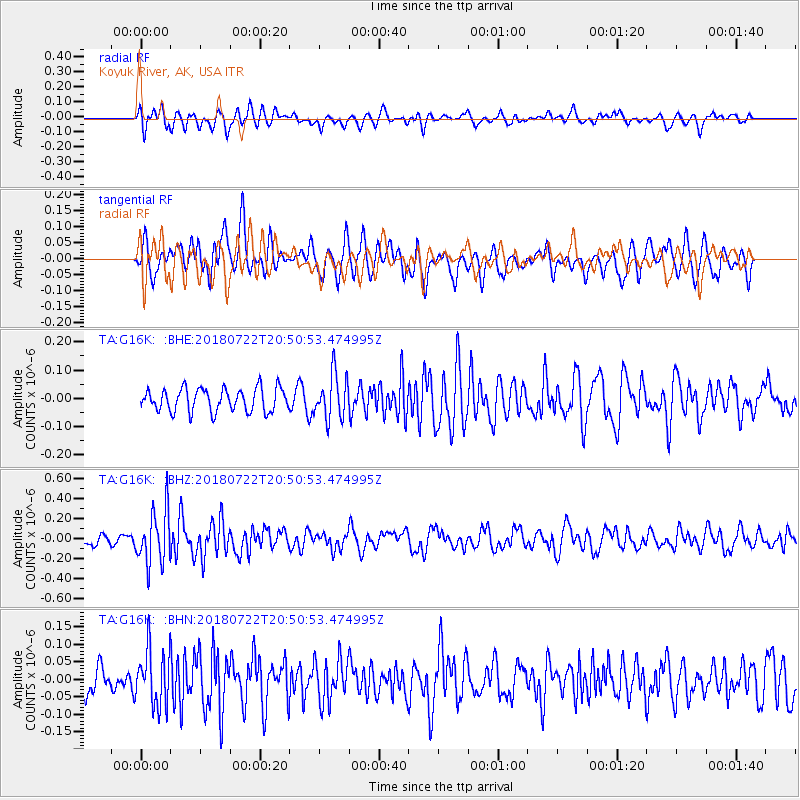
G16K Koyuk River, AK, USA - Earthquake Result Viewer
*The percent match for this event was below the threshold and hence no stack was calculated.
| Earthquake location: |
Northern And Central Iran |
| Earthquake latitude/longitude: |
30.4/57.4 |
| Earthquake time(UTC): |
2018/07/22 (203) 20:39:17 GMT |
| Earthquake Depth: |
10 km |
| Earthquake Magnitude: |
5.5 Mww |
| Earthquake Catalog/Contributor: |
NEIC PDE/us |
|
| Network: |
TA USArray Transportable Network (new EarthScope stations) |
| Station: |
G16K Koyuk River, AK, USA |
| Lat/Lon: |
65.39 N/162.35 W |
| Elevation: |
169 m |
|
| Distance: |
79.7 deg |
| Az: |
15.804 deg |
| Baz: |
325.814 deg |
| Ray Param: |
$rayparam |
*The percent match for this event was below the threshold and hence was not used in the summary stack. |
|
| Radial Match: |
63.033653 % |
| Radial Bump: |
400 |
| Transverse Match: |
59.228405 % |
| Transverse Bump: |
400 |
| SOD ConfigId: |
13570011 |
| Insert Time: |
2019-04-30 15:32:03.962 +0000 |
| GWidth: |
2.5 |
| Max Bumps: |
400 |
| Tol: |
0.001 |
|
Signal To Noise
| Channel | StoN | STA | LTA |
| TA:G16K: :BHZ:20180722T20:50:53.474995Z | 4.596168 | 2.6703248E-7 | 5.8098937E-8 |
| TA:G16K: :BHN:20180722T20:50:53.474995Z | 2.1040611 | 8.0012754E-8 | 3.802777E-8 |
| TA:G16K: :BHE:20180722T20:50:53.474995Z | 1.9139863 | 7.849231E-8 | 4.100986E-8 |
| Arrivals |
| Ps | |
| PpPs | |
| PsPs/PpSs | |


