You are here: Home > Network List > TA - USArray Transportable Network (new EarthScope stations) Stations List
> Station H16K Elim, AK, USA > Earthquake Result Viewer
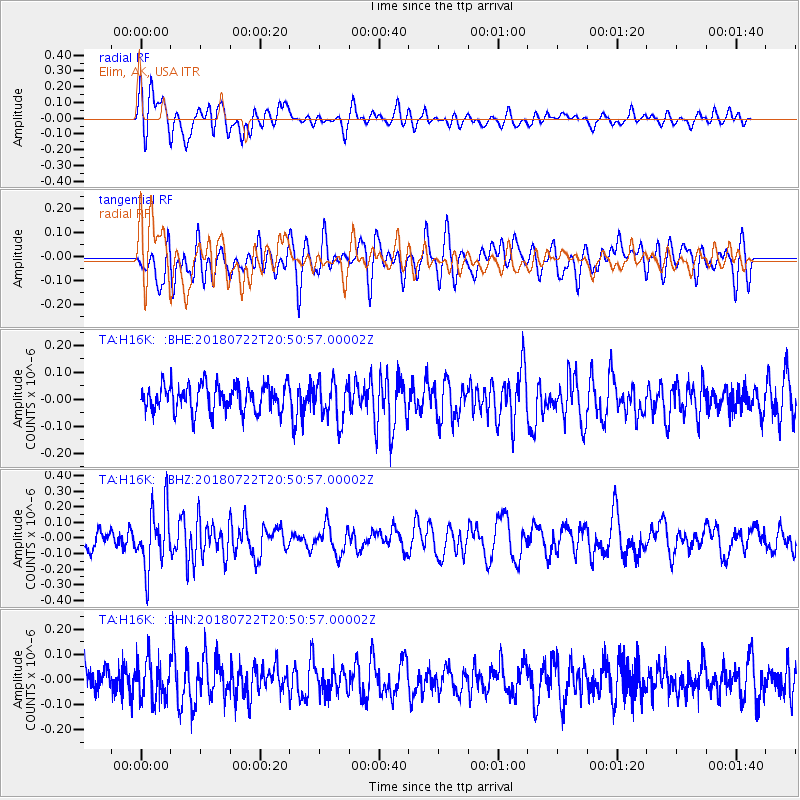
H16K Elim, AK, USA - Earthquake Result Viewer
*The percent match for this event was below the threshold and hence no stack was calculated.
| Earthquake location: |
Northern And Central Iran |
| Earthquake latitude/longitude: |
30.4/57.4 |
| Earthquake time(UTC): |
2018/07/22 (203) 20:39:17 GMT |
| Earthquake Depth: |
10 km |
| Earthquake Magnitude: |
5.5 Mww |
| Earthquake Catalog/Contributor: |
NEIC PDE/us |
|
| Network: |
TA USArray Transportable Network (new EarthScope stations) |
| Station: |
H16K Elim, AK, USA |
| Lat/Lon: |
64.64 N/162.24 W |
| Elevation: |
216 m |
|
| Distance: |
80.3 deg |
| Az: |
16.194 deg |
| Baz: |
325.987 deg |
| Ray Param: |
$rayparam |
*The percent match for this event was below the threshold and hence was not used in the summary stack. |
|
| Radial Match: |
58.314045 % |
| Radial Bump: |
400 |
| Transverse Match: |
57.845856 % |
| Transverse Bump: |
400 |
| SOD ConfigId: |
13570011 |
| Insert Time: |
2019-04-30 15:32:10.463 +0000 |
| GWidth: |
2.5 |
| Max Bumps: |
400 |
| Tol: |
0.001 |
|
Signal To Noise
| Channel | StoN | STA | LTA |
| TA:H16K: :BHZ:20180722T20:50:57.00002Z | 2.429148 | 1.9028998E-7 | 7.83361E-8 |
| TA:H16K: :BHN:20180722T20:50:57.00002Z | 1.6213166 | 7.9643215E-8 | 4.912256E-8 |
| TA:H16K: :BHE:20180722T20:50:57.00002Z | 1.4495883 | 7.1868875E-8 | 4.9578823E-8 |
| Arrivals |
| Ps | |
| PpPs | |
| PsPs/PpSs | |


